Sunday, March 23, 2014

Morristown National Historical Park, NJ - Jockey Hollow Area

March 23, 2014

Miles: 7.9
Time: 3 hours 25 minutes
 
Parking: Large lot. GPS Coordinates 40.772242, -74.527680

Rest rooms: Indoor rest rooms at the parking lot. They even felt heated.Hike directions: NJ Morristown National Historical Park

Map: Jockey Hollow

Hike description: Easy hike, mostly flat. Lots of dog walkers and joggers. Signs of horses as well on some trails. Lots of opportunities to come up with shorter or longer hikes. Trails were well marked (with maps at most intersections), however we still managed to take a wrong turn somewhere (where there were many intersecting trails). Not a problem - the you are here maps helped us out. Many intersections were numbered, but our map wasn't. Our hike was virtually snow-free! There is a mountain that we considered bushwhacking to (no trail goes to it), but there were too many thorny bushes to make that any fun. Some parts of the hike had streams, so we stopped at one on the red trail to throw sticks for the dogs. The park was does pass the back yards of some houses on occasion. The park was very clean - very little litter. 

Year to date miles:   90.8

Trail head at the parking area

Example of trail intersection. Very handy "You are here" maps. 

The trails were also clearly blazed.

Replica military cabins


Got a laugh out of this photo

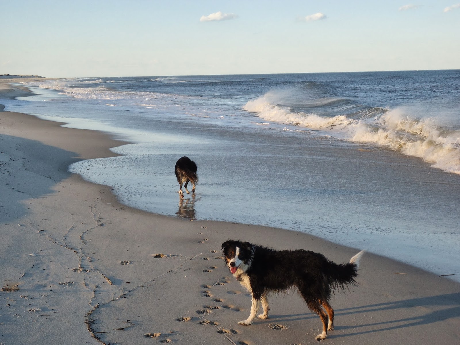
Taking a swim break for the dogs (the only time we decided to take them off leash), and a pumpkin bread break for the humans.


Sunday, March 16, 2014

Columbia Trail, High Bridge to Lockwood Gorge, NJ

March 16, 2014

Miles: 8.5
Time: 

Parking: 79 Main Street, High Bridge, NJ. Tons of room.

Rest rooms: A partially broken down portapotty in the parking lot. But not much opportunity on the trail, so it's the best place.

Hike directions: Best Hikes With Dogs, New Jersey hike #22

Map: Columbia Trail

Hike description: I found this hike rather dull. We went to NJ to escape the snow, but this trail ended up being super icy once we reached the gorge. The hike starts directly across the street from the parking lot. It is paved briefly, and then becomes gravel. The trail is on an old railroad bed. So, it is very level and easy. I found the beginning of the trail quite ugly & urban, however we kept finding gnome houses which humored us. More on the gnomes: Challenge the Whole Family Hunting for Gnome Homes Along the Columbia Trail. The trail got nicer when you could see the river below. But, once we came to that spot, the trail became snow covered, and very icy. We hadn't packed our microspikes, figuring that the hike would be snow free. The trail is marked with markers every 1/4 mile, so you know exactly how far you've gone. We decided to turn around shortly after the 4 mile marker. This trail was popular with joggers. There were also signs of horses. There was a lot of garbage, un-picked up dog poop (both bagged and not) on the trail.

Year to date miles:   82.9


A sign a short way after the trailhead. The beginning of the trail is very urban, passing by many houses.

One of the gnome houses

Fresh eggs for sale (we saw the chickens), but already sold out


Another gnome house

Ugg....very difficult walking - everything was hard ice

This one is a smurf house

Mile markers, which are placed every 1/4 mile


The river down below

Island Beach State Park, NJ

March 15, 2014

Miles: 5.8
Time: 2 hours 30 minutes 

Parking: Interpretive Center, Island Beach State Park, Seaside Park, NJ. There was a $10/out of state car fee to enter the park. There are multiple parking lots, but at this parking lot, there were around 8 parking spots.

Rest rooms: At the Interpretive Center

Hike directions: Hiking New Jersey hike #49

Map: Island Beach State Park (also the book).

Hike description: A short trail starts at the nature center and heads towards the ocean. From there we headed south on the beach until we reached the end & turned around. There were occasional 4x4's on the beach - they drive them onto the beach to go fishing. But, otherwise it was pretty quiet. We were able to let the dogs off leash & run, just putting them on leash when we saw a 4x4 heading our way. I've seen photos from another person hiking here, where there were many, many more 4x4's on the beach.

Year to date miles:   74.4


Sign for the parking area for the start of the hike

A sign said there was no beach access. However, there is a short nature trail that starts between these two buildings.

We arrived at a T intersection, where we turned right.
Once we hit the ocean, we turned right and kept walking.

Lighthouse, which you can't walk to. Some areas near the end of the beach were fenced off with snow fencing.
In addition, one area was roped off with string (which we didn't see until we walked into - to protect some plants.

This is an out and back. Turned around once we reached the jetty, to return to our starting place.
The sign to where you leave the beach to return to the nature center says #16.

It was a super windy day, with lots of blowing sand at times.
Even the spray from the waves was blowing backwards.


There was a large plume of smoke covering the sun. We were guessing this came from the pine barrens.
Our original hiking plan was to hike in the pine barrens, but they were doing a controlled burn of the forest there.


Sunday, March 9, 2014

Perrineville Lake Park, NJ

March 9, 2014

Miles: 6.6
Time: 2 hours 50 minutes  
Elevation gain: 968 feet

Parking: See Hike directions. Room for around 6 cars.

Rest rooms: At Aggress Rd parking lot.

Hike directions: See Gone Hikin's write up: Perrineville Lake Park

Map: Perrineville Trail Map

Hike description: We were looking for a NJ hike to escape from the snow. Large portions of this hike were completely snow free. This looks like a popular place for local dog walkers. I think this would be a prettier hike after everything turns green. I did enjoy walking next to the farming fields, where there was a wide mowed area, sometimes completely snow free. The dogs had a great time getting some running in. This hike passes two lakes, which look like they would be great for taking dogs swimming in during the summer.

Note: A sign noted that deer hunting is allowed from October 1 - February 15th.

Year to date miles:   68.6


Trail head

The trail markers were on posts. On occasion I wished there were a couple more posts, but  checking the map, it wasn't difficult to determine where you were.

We were disappointed with the start of the hike. All of these snow-free fields, and the trail is on the snowy portion!

Heading into the woods, there were signs of mountain bikers and horses.

Now this is what I'm talking about - a mowed, snow-free path next to the fields.
Run puppies, run!

A small pond we passed - too early for swimming

A parking lot next to the lake loop. A lot of dog walkers started here, and just did the lake loop.


Saturday, March 8, 2014

CT Appalachian Trail - Section 3 - Route 112 to Sharon Mountain

March 8, 2014

Miles: 4.3
Time: 3 hours 6 minutes
Elevation gain: 1403 feet

Parking: 
Route 7, just north of the intersection with Route 112 (Lime Rock Road). There is room for around 10 cars in a parking lot off the road. The parking lot was plowed!

Rest rooms: none

Hike directions: 
From parking area, head towards field (not on the road). Walk briefly northbound, then start a clockwise loop around a field before heading southbound. Cross Route 7 at the end of the field. Continue along the AT passing Belter's Bump (there is a sign on a tree), Belter's Campsite (again a sign), a stream (sign for water) just past the campsite, and then head up Sharon Mountain. There is a ridge walk with some views. Our map shows Sharon Mountain has two 1,370 foot peaks. We made it to the first one. We had a late start, and didn't have time to get to the second one. 

Map: Appalachian Trail Guide to Massachusetts Connecticut  or Connecticut Walk Book West

Hike description: The beginning of the hike had deep snow and the trail was only partially broken. We used snowshoes, but we sank a lot in the melting snow. The dogs had a difficult time too. After crossing Route 7, the snow on the trail was much more packed down by others using snowshoes. But, it was still slushy snow so tiring. Once we got close to the summit, all of a sudden we came across completely unbroken trail. It became exhausting. I led the way, and every step I would sink 8" down. The dogs were ahead of me, and had a terrible time with the snow. We had to turn around when just past where the trail passed Sharon Mountain Road (can't be seen from the trail, but we saw on our map).

Year to date miles:   62


Our original plan was to hike another portion of the AT, but we couldn't find a place to park.
This parking area was plowed & large!

Looking back at the field we passed.


View from Belter's Bump

Campground - no sign of recent visitors

Unbroken trail. Exhausting for the dogs too, because they couldn't stay on top of the deep snow.

Heading up to the second peak of Sharon Mountain. Became too exhausted, and it was time to turn around.

On the way back.....we passed what looks like a woods road, but this wasn't on our map.

View, not the summit though

It was easier to just hike single file, even for the dogs.


Sunday, March 2, 2014

Seven Hills/HTS/Reeves Brook Trail Loop to Ramapo Torne and Torne View, Harriman

March 2, 2014
Distance: 5.2 miles 
Time: 3 hours 30 minutes  

Map: Harriman Bear Mountain Trails (South Map)
Parking: Parking lot at visitor center, plus on street parking
Restrooms: At visitor center, seasonal
Post hike dinner: n/a


Directions: Seven Hills/HTS/Reeves Brook Trail Loop to Ramapo Torne and Torne View

This is a popular place to start a hike. The parking area/street had a fair number of cars given that it was a cold winter day. If you want solitude, this might not be a good hike to try on a weekend. Strangely enough, we only saw 2 other people on our hike! We saw a number of people in the parking area with snowshoes, but we decided to just bring microspikes, and they were sufficient. The trails were packed down and we had no problem with postholing, though we did need to be careful where we stepped, so we wouldn't step into previously created postholes. This hike had one steep downhilll part where we had to be careful, even with microspikes. The last time we tried this hike, we encountered a forest fire: Ramapo Torne Harriman

Year to date miles 57.7


Reeves visitor center. Normally you have to park on the road to start a hike from here.

We had a number of stream crossings, and the dogs stopped and stood in every stream, despite it only being in the 30's.

View from the Torne.


View past the Torne

Although we found this hike well blazed, it was sometimes hard to find blazes due to the snow.

The snow was packed, and we encountered some very icy spots.

View of the Torne from the spot called "Torne View" on the map.