| Date |
Distance |
Time |
Elevation Gain |
Average Moving Time |
Year to Date Miles |
| 6/23/2025 |
2.5 miles |
1 hour 6 minutes |
40' |
2.2 mph |
223.2 miles |
Parking: - Price Lake Boat Rentals, Blue Ridge Parkway
Map:- Hike counterclockwise around the lake from the boat launch parking area.
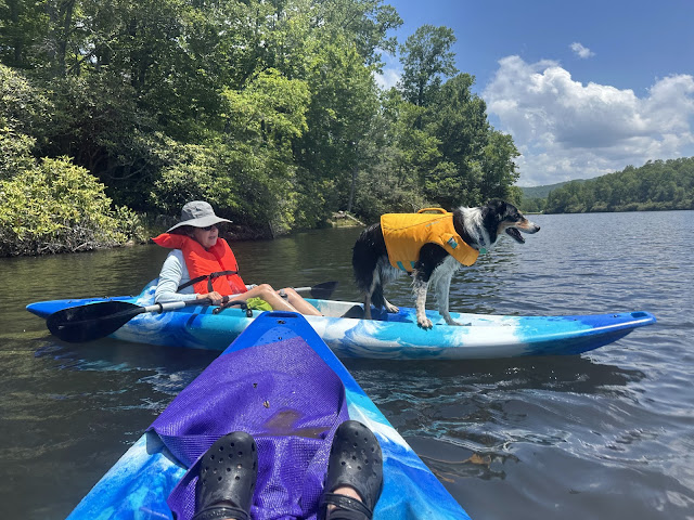
Glen, Marie, Krumm, and I went kayaking today at Price Lake. We are in the middle of a heat wave, so kayaking sounded like a great idea. I think of Price Lake as being at higher elevation, but its only 3,410', so while it is cooler than Asheville, it was still quite hot. The folks who work at the boat rental are always very nice. When they saw Krumm, they asked if we wanted a no slip mat for our kayak - but we actually bring our own yoga mat for him. We had a fun time kayaking. We let Krumm jump from my boat to Marie's boat - a good thing to practice. We've been doing a lot of swimming practice locally this summer, so he's getting more confident about jumping out of the kayak. Once he's on shore, he wants to wade along the shore rather than jump back into the kayak. Some year I hope to own our own kayaks.
After our kayak, we hiked the Price Lake Loop, a short flat loop around the lake. Part of it was shaded, but when the trail was in the sun, it was hot. Not as hot as Asheville, but ugh, enough with this heat. We saw some very cool fish - blue/grey and yellow/red ones.
 |
| Krumm after kayak jumping! |
 |
| Taking a break to fetch sticks |
 |
| Any fish experts who can identify these 2 species? |


