| Date | Distance | Time | Elevation Gain | Average Moving Time | Year to Date Miles |
|---|---|---|---|---|---|
| 11/19/2022 | 8.3 miles | 3 hours 49 minutes | 504' | 2.5 | 908.7 |
- Turkey Pen Gap Trailhead
- Pisgah Map Company, Pisgah Ranger District (for navigation)
- 100 Favorite Trails of the Carolinas and the Blue Ridge (for directions)
- See 100 Favorite Trails map
Carolina Mountain Club Challenges:
- 100 Favorite Trails Challenge
- Pisgah 400 - #133 South Mills River Trail (partial)
We were joined today by Phyllis and Paul for a 100 Favorite Trails hike. Turkey Pen Gap has a reputation of being a bad road to drive on (requiring a high clearance vehicle), but the road was actually in good shape today.
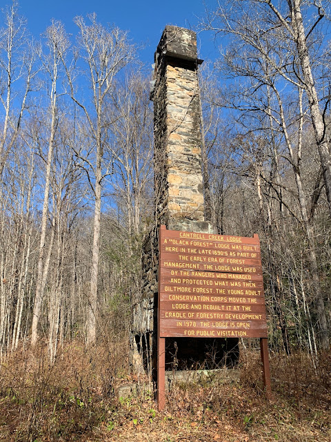
This was a very easy hike. It has a little bit of elevation change in the beginning, but the majority of the hike is flat. It had several stream crossings, but there are suspension bridges to help you get across. The first suspension bridge had big gaps between the boards. Krumm was not happy. He splayed his feet and kept his center of gravity low. The bridge is rather bouncy. I think we ended up having 6 suspension bridge crossings. He got braver by the end. He would have preferred to wade through the river. We felt slightly seasick after each bridge crossing! I've never encountered that before on a suspension bridge. The end of the hike is a chimney of the former Cantrell Lodge. I think the lodge has been moved to the Cradle of Forestry. Phyllis and I wanted to turn the hike into a longer loop hike, but Glen's ankle was bothering him, so we just did it as an out and back.


No comments:
Post a Comment