
| Date | Distance | Time | Elevation Gain | Average Moving Time | Year to Date Miles |
|---|---|---|---|---|---|
| 11/13/2021 | 8.3 miles | 6 hours | 2,348' | 1.6 | 450.9 |
Map:
- Appalachian Trail Conservancy, Tennessee-North Carolina, Maps 3 & 4
Parking: Lemon Gap
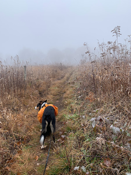
Today we worked on filling in a gap of a section we needed to do on the Appalachian Trail. The drive to this trailhead is around 1 1/2 hours for us. One half of that time is just on Max Patch Road! Max Patch Road starts out paved, but then becomes a dirt/gravel road. And yes, its around 45 minutes on that road. The unpaved portion was in pretty good condition though. It was incredibly foggy this morning. We were in the clouds. The Lemon Gap parking area was pretty crowded with a group of teenagers heading out on a backpacking trip - hiking from Lemon Gap to Max Patch is a popular backpacking trip. It was 29 degrees at the trailhead. Brrr....that is way too cold for me for backpacking. Most people who park at Lemon Gap are heading to Max Patch, but we were headed in the opposite direction.
I was under dressed today. I was wearing leggings and trail runners. I am getting used to North Carolina weather. On my Wednesday hike this week, I was wearing a short sleeve shirt. I saw the temperature was going to be a high of 44 degrees in Hot Springs. I brought appropriate clothes (fleece, puffy, gloves, mittens, neck gaiter, extra socks, hat, etc.), except for leggings. The fronts of my thighs were freezing. I ended up wearing my fleece across the front of my thighs, to keep them warm (attaching it to my backpack hip belt). It is hunting season here, so I wore a blaze orange hat, but we saw no hunters.
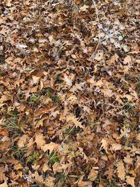
Today's hike had ups and downs. As we ascended, we saw frost on the filmy angelica flowers - this was so pretty! We passed by a meadow, but couldn't see anything as we were hiking in the clouds. As we approached Bluff Mountain, there was a thin coating of snow on the ground. My feet got wet, as I was only wearing trail runners. We continued a short distance past Bluff Mountain, onto the section of trail we maintain. We knew there was a down tree in our section that we were supposed to take care of, but we didn't hike far enough to get to it. Bluff Mountain doesn't normally have views, but today with the leaves down at the summit, we could see views (just past the summit). We were surrounded by snow covered trees, looking down at smaller mountains with colorful red fall foliage. Beautiful. We headed back to the summit of Bluff Mountain, and stopped for a lunch break. On the way back, we did some trail maintenance. We removed 5 trees across the trail, and threw branches off the trail. This isn't our section, but we had a saw and some time, so we stopped to clear out what we could. We also took notes/photos on trees leaning over the trail, that require a sawyer to remove. We got a little bit of sun/blue skies on the way down.
On the way home, our car navigated us the opposite way down the road - away from Max Patch. The unpaved road in this section is rougher (at least as of today). Taller rocks in the road, deeper ruts. Next time, we will make sure not to go this way.


No comments:
Post a Comment