
| Date | Distance | Time | Elevation Gain | Average Moving Time | Year to Date Miles |
|---|---|---|---|---|---|
| 10/10/2017 | 6.6 miles | 3 hours 47 minutes |
Map: Appalachian Trail Guide, New Hampshire-Vermont, plus map that comes with the book
Parking: Left first car at VT 103, left second car at VT 140 (3 spaces on the road, or a parking lot off the road)
Directions: Hike northbound on AT from VT 140 to VT 103.
Glen's hip was still hurting, so we took Monday off as a rest day. We never really plan non-hiking things to do on vacations. We ended up sleeping tons and missed the hotel breakfast. We stopped by Denny's and ate there (they actually have a nice breakfast that can be made vegan). We went to the movies and saw Brad's Status, which was predictable, but better than expected. We went to the grocery store not once but twice. We also spent a bit of time trying to locate a decent pair of trekking poles for Glen. We have extra poles at home, but no extra poles with us. Glen no longer normally hikes with poles, so he hadn't brought any. We figured it would help him with his hip pain so we went shopping for some. Dick's Sporting Goods had pretty lousy poles. We went to an outfitter, but all they had were ski poles. This area is much more geared to skiers than hikers. One outfitter sent us to another, which stocked only 1 brand of poles, but at least they were good. Later on we went to see the movie Battle of the Sexes, which we both really liked. Dinner was at the Vermont Tap House, where we got pizza and tried another Vermont Craft brew - Fiddlehead. Oddly, this one also tasted like grapefruit.
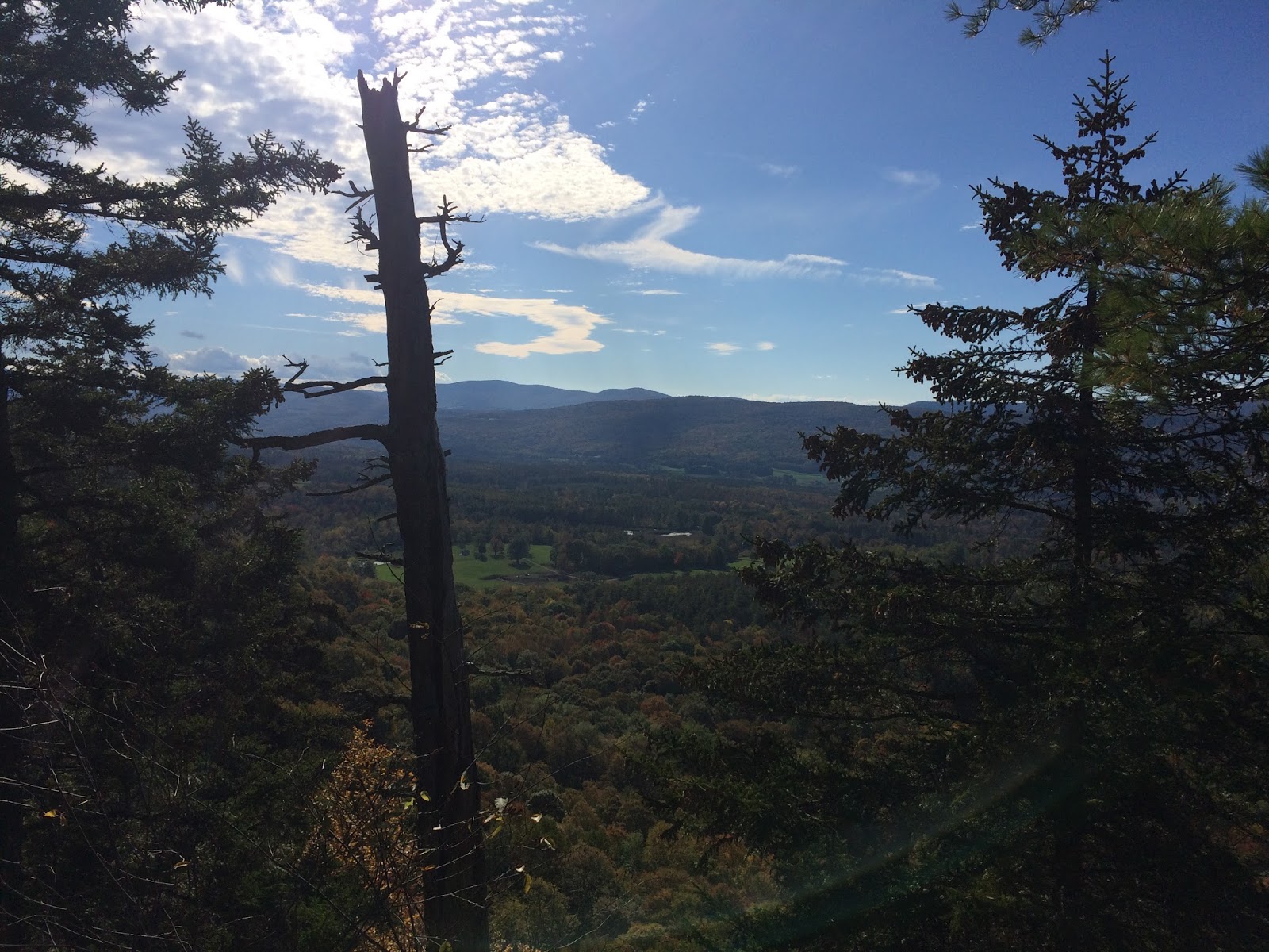
We decided to try a shorter hike today, to see how Glen's hip would do. He continued to take Naproxen. Glen did okay luckily. We parked our second car on the shoulder of VT 140. After a few feet of heading north, we hit the AT parking lot that was also off VT 140. We were going for a short hike today and really took it easy. We hiked slowly. We stopped at the Domed Ledge Vista and decided to sit down and practice our map and compass skills. Unfortunately, we were on the bottom corner of our map, so it was really hard to have perspective about what we were seeing. We saw many mountains, but the corner of our map only showed 2.
We passed a number of side trails on our hike, which weren't listed on the Guthook app that we use. We passed by a shelter, but didn't stop there. We saw a handful of backpackers, but mostly had the trail to ourselves today.
Near the end, we stopped at something called the airport view. It didn't sound great, but actually was pretty nice. It was more than just a view of the local tiny airport. We sat down and had a long break.
We continued downhill to a gorge which was quite pretty. A suspension bridge crossed it. It moved when you walked across it - we went over one at a time.
Tonight we stopped at the local food coop to pick up dinner. It was small and didn't have much in the way of prepared food. Rutland is a small touristy town, but isn't really exciting for vegetarians/vegans.
 |
| This is the non-roadside parking area. It's pretty easy to miss from the street. |
 |
| We saw quite a few red efts this week. |

 |
| We took this short side trail |
 |
| We sat down for a while and practiced map and compass skills. |


 |
| Airport view, which was prettier than it sounds |
 |
| We had plenty of time, so we took a long break here (airport view) |


 |
| Clarendon Gorge |
 |
| Suspension bridge over the gorge. It moves! |
 |
| Clarendon Gorge |


No comments:
Post a Comment