| Date | Distance | Time | Elevation Gain | Average Moving Time | Year to Date Miles |
|---|---|---|---|---|---|
| 7/29/2017 | 4 hours 45 minutes |
Map: NYNJ Trail Conference, Catskills, Trail Map 141
Parking: Roaring Kill Road
Directions: Yellow blazed Roaring Kill trail. Left on blue blazed Pecoy Notch trail. Right on red blazed Devil's Path. Summit Sugarloaf. Right on blue blazed Mink Hollow trail. Left on yellow blazed Roaring Kill trail.
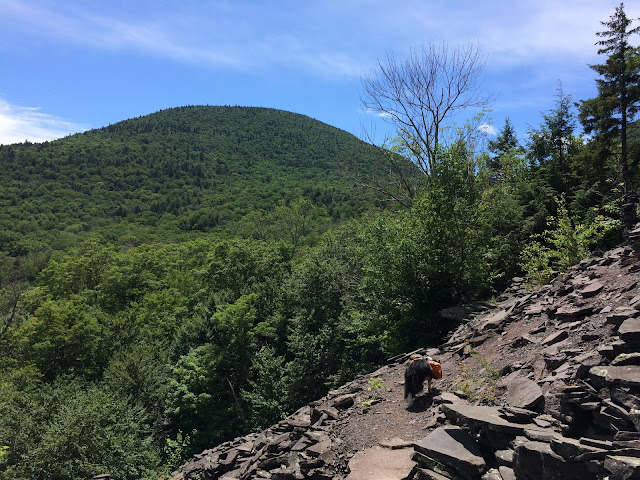
I was a little apprehensive about this hike, as it was listed as extremely difficult. We had hiked Sugarloaf before, so I'm not sure why I was worried. My hip was sore but good enough to hike. The trail came across the really fun rock quarry section which has several rock chairs. I didn't take photos, because the area was crowded with visitors. It seems like lots of people hike just to the quarry and then turn around. I can see how it would be a popular place for taking children, because its fun! We continued on, and then there were fewer people. Hiking on the Devil's Path was fine. There is rock scrambling, but nothing that is too hard in the summer (this hike is really, really hard in the winter due to ice). We came across views both before and after the summit. The summit itself doesn't have a view.
At the intersection of the Devil's Path and the Mink Hollow Trail, we met a backpacker who was giving up on his hike, and asked us to help him get to someplace with cell service. He hiked out to the parking area with us, but ended up not needing a ride, because he was able to get reception in the parking area.
This hike helped us finish 3 trails on the Catskills All Trails challenge, which we are starting to work on again. No goals on when we'll complete it, but just plugging away at it. We are running out of AT hikes within driving distance, so I think we'll be focusing on Catskill hikes more now.
 |
| Rock chairs before the main quarry |
 |
| The trail passes a beaver pond |
 |
| One of the steeper sections, where you grab onto the tree roots to help climb up. |
 |
| Oops - backpacks sometimes get in the way |
 |
| Viewpoint after the summit which is not as open as the viewpoint before the summit |
 |
| This hike has a couple of places where dogs need assistance. Harnesses are really helpful. |


No comments:
Post a Comment