
Miles: We had problems getting an accurate GPS reading for some reason. We are approximating 10 miles.
Time: all day....
Year to date miles: 222.2
How to get there from Wengen: Take the train from Wengen to Lauterbrunnen. Walk behind the train station and look for the yellow train signs.
Rest rooms: Behind the Lauterbrunnen train station. Also at Trummelbach falls. And probably also at the Schilthornbahn.
Hike directions:
Lauterbrunnen Station - Trummelbach Falls
Trummelbach Falls - towards Stechelberg
Towards Stechelberg - Schilthornbahn
Schilthornbahn - Stechelberg
Stechelberg - starting towards Murren
Starting towards Murrren - Stechelberg
Stechelberg - Lauterbrunnen
Map:
Hike description: There was a strong chance of afternoon thunderstorms, so we decided to stay in the valley. We had a little bit of rain, but it wasn't bad, and was mostly a sunny day. Often the weather in Lauterbrunnen will be much sunnier than in the mountains. Trummelbach falls is a recommended trip for a rainy day, as it doesn't matter what the weather is like. You can take a bus to Trummelbach falls, but we preferred walking. This is a very easy walk. Most of it is on pavement, and it is flat. There are many, many waterfalls, and you will see paragliders and possibly base jumpers.
 |
| They even have trail signs inside the train station. I love hiking here! |
 |
| The hike starts behind the train station, where you will find these signs. We started out heading to Trummelbach falls. |
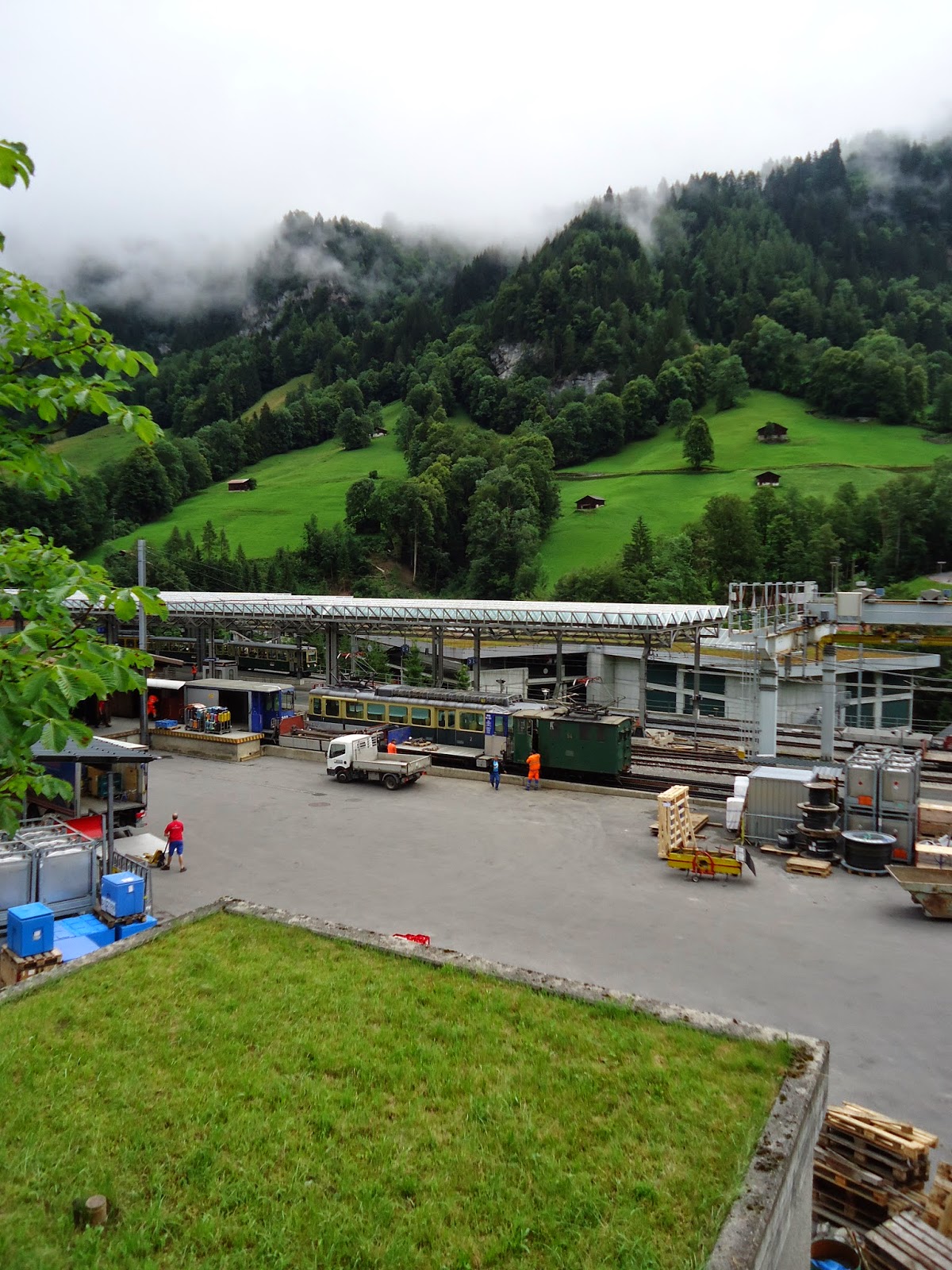 |
| Lauterbrunnen train station |
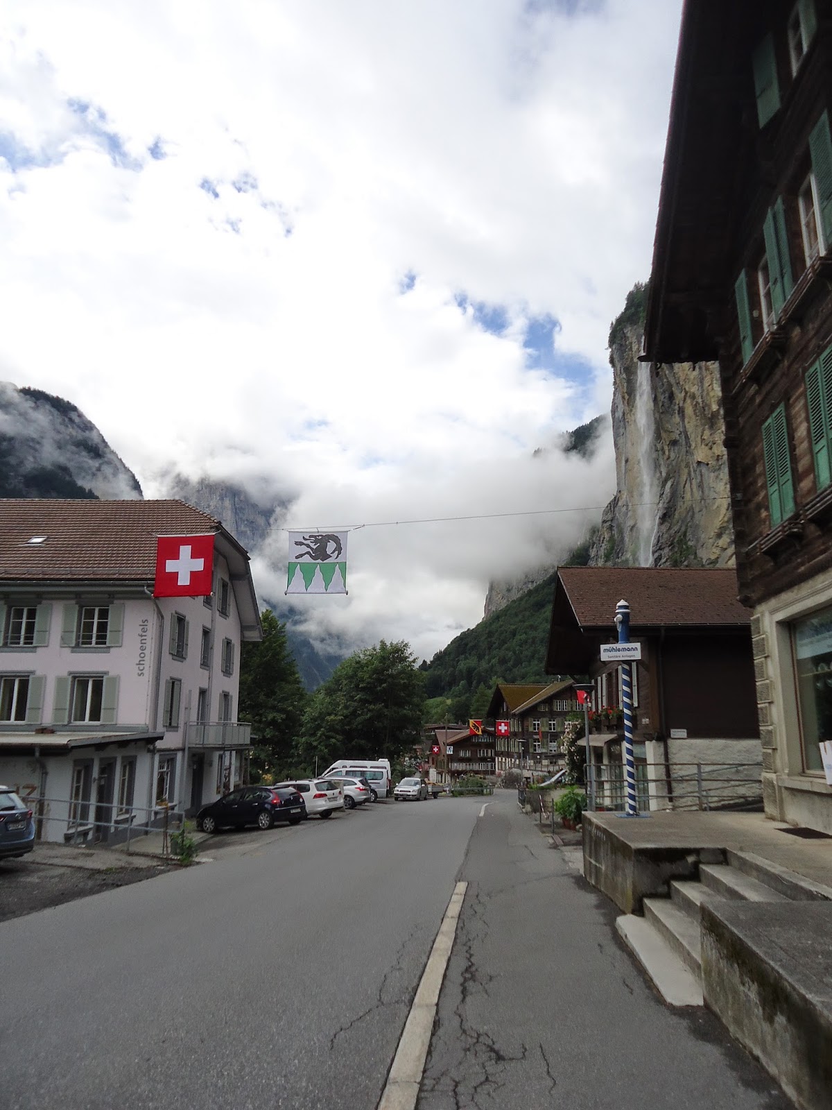 |
| The hike starts out walking in the middle of the town. Just keep checking the yellow trail signs. |
 |
| We passed by this cemetery, where every grave had a flower plot |
 |
| Lauterbrunnen is a valley with cliffs on both sides. After passing through the town area, this hike is along gravel/quiet paved road, and passes through pastures. |
 |
| This is the quiet paved road. Only an occasional car. |
 |
| At this point, we took a left to visit Trummelbach falls. After visiting the falls, we returned to this spot, and continued to Stechelberg. |
 |
| Crossing on a bridge over this river (very grey water) which is fed by glacier water. |
 |
| We have found Switzerland to be very dog friendly. We've seen many calm, off-leash dogs. Dogs on trains, dogs in restaurants. But, they are still sensitive about poop :) I forgot to get a picture - but one brand of poop bags is called "RabidDog" |
 |
| Trummelbach falls is a very popular tourist site. There will be tour buses. |
 |
| It was hard to get photos that captured the falls. But, they were a really interesting site. |
 |
| The falls are inside a cave like area (making photos hard). They are very loud, and a raincoat is recommended. |


 |
| An "elevator" or sorts takes you part way up. Then there are still additional flights of stairs up. Additional viewing areas means more flights down to the bottom. It is wet inside. |
 |
| There is a restaurant at the falls and bathrooms. |
 |
| We headed back towards Lauterbrunnen Station temporarily. |
 |
| Until we reached this sign again, where we headed to Stechelberg |
 |
| There are many drinking areas like this in Switzerland. Half the time I can't figure out if they are for humans or cattle. This one is for humans. |
 |
| This is a very popular area for paragliding. We also saw a few base jumpers - I practically had a heart attack when I saw the first one. |
 |
| We ended up visiting the Schilthornbahn on the way to Stechelberg. |
 |
| I love cairns :) |

 |
| Cable car above |


 |
| The weather in the valley was sunny - so we thought there was a chance there might be a view on top of the Schilthorn. There is a cable car up to the Schilthorn - where you buy the tickets they have a monitor which displays the current view from the Schilthorn. It looked very clouded in, and the tickets were expensive, so we decided to save this for a clearer day. We crossed the river to the station, and then came back over it to continue on to Stechelberg. |
 |
| Schilthorn Station |


 |
| Hydro electric plant at Stechelberg. There is a postbus that can take you back to the Lauterbrunnen train station. We started heading up to Murren instead. |

 |
| The start of the river we have been crossing, comes from this waterfall from the mountains. This is in the beginning of the hike up to Murren. We heard lots of rumbling at this time (I think it ended up being military planes, not thunder), so we turned around. |
 |
| I tried to get a good photo, but this guy moved fast. It is a black alpine salamander. They come out in the rain. |
 |
| View of Lauterbrunnen valley. We walked back from Stechelberg to the Lauterbrunnen train station. |
 |
| Passing pastures along the way. |
No comments:
Post a Comment