Sunday, November 25, 2012

Millers Pond State Park, CT

November 25, 2012

Distance: 5 miles
Time: 2 hours 38 minutes
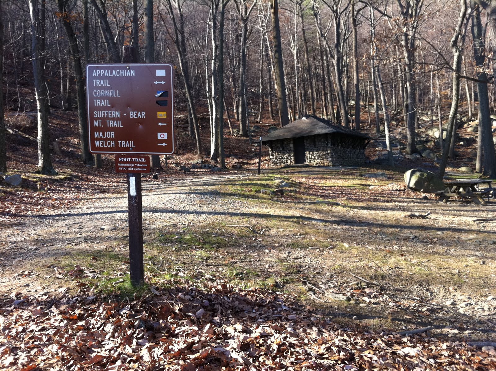
Map: Millers Pond Trail Map (There is a map at the trailhead, but it is out of date. The online map shows more trails than the map at the kiosk at the parking lot).
Parking: Large lot on Foot Hills Road, Haddam, CT, room for around 50 cars
Restrooms: Map showed they exist, but there were none
Post hike dinner: none

Directions:
At back of lot, pass kiosk, and turn left onto red blazed trail.
Turn left on yellow blazed trail (this road parallels the road)
Turn left on the red blazed trail at the end of the yellow blazed trail.
At intersection with red/white trail, keep left on red blazed trail.
Turn right on blue trail, heading towards the pond.
When you reach the pond, turn right on the blue & white blazed trail.
Walk along the trail as it parallels the lake.
When the blue & white trails split, stay on the white trail next to the lake.
Parking lot will be on the right.

There are shorter & longer hike variations available.

Notes:
This trail had a lot of "pointless left & rights." The trail was a constant zigzag. I'm guessing it was designed more as a mountain bike trail than a hiking trail. There were quite a few cars in the parking lot, but not many people on the trails. We saw a couple of mountain bikers. Most of the people walking, were walking along the trails by the lake. I didn't find this hike very interesting. The lake at the end would be a good place to take dogs swimming though, and is close to the parking area.

Year to date miles: 376


Sign for the parking area
Overlap in training - teaching Trek to turn around on the dogwalk
And here is Trek offering two on two off. More dogwalk training.
Sometimes the blazing was unusual. This means turn left to stay on the red blazed trail, or turn right to go on the red/white blazed trail.
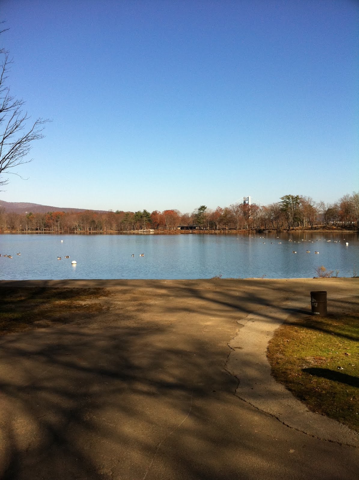
Approaching the lake
Moxie's head peaking out from the edge of the pond.
Please take this stick & throw it in the pond.
Trek went for a quick swim.

Bear Mountain, NY

November 22, 2012

Distance: 4.4 miles
Time: 3 hours 10 minutes
Map: Harriman - Bear Mountain Trails (north map)
Parking: Next to Bear Mountain Inn, enormous lot
Restrooms: across from Merry-go-round before hike, and also at summit
Post hike dinner: Jaipore, Brewster, NY
Directions: Bear Mountain

Notes:
This is a loop trail, ascending to the summit on the very steep Major Welch trail, and descending via the more gradual AT. I highly recommend doing this way versus ascending via the AT and descending via the Major Welch trail. The AT portion has stone steps, making the hiking much easier. The steep Major Welch trail, although very tiring, is easier on the knees to climb up rather than down. The climb up has 1 road crossing near the summit. We came across a few groups also hiking up. Once you get to the summit, there are lots of people, because there is a road to the summit. The views on top are nice, but there were so many people up there, we didn't stay long. On the way down, we were hiking practically in a line of people down the AT. There were 3 road crossings (of the same road which leads to the summit). I recommend doing this hike on a weekday.

Year to date miles: 371

Parking area. Looking at the Bear Mountain Inn.
Head towards the inn, and take a left.
Past the inn, is a sign showing the trails. Follow the Major Welch trail.
The trail follows a paved path next to Hessian Lake. Bear Mountain Bridge in the background.
The Major Welch Trail is steep!
View on the ascent.
View of the Hudson River
Sign near the summit (looking back at the trail).
Perkins tower at the summit.
View at the summit
Descending along the AT, the trail follows the road briefly.
View of Iona Island and the Hudson

Sunday, November 18, 2012

MA Appalachian Trail - Section 10 - Guilder Pond Picnic Area to Jug End

November 18, 2012
Distance: 5.6 miles
Time: 3:32 hours
Map: South Taconic Trails or Mount Everett State Reservation

Parking: Take Route 344 (very narrow!) to end. Turn right on West Street. Turn left on Cross Road. Turn Left onto East Street. Turn right onto dirt road at sign for Mount Everett Reservation. Go through gate (closes at 8pm). Pass a small picnic area for Guilder Pond. There is room for 3-4 cars to park here. Continue to a larger parking area where there is a sign for the AT. Park here. There is room for a lot more cars here. There was a second gate here (shut), for a gravel road leading to Mt. Everett.
Restrooms: In parking lot, also a privy at the shelter on the trail.
Post Hike Dinner: Aroma Bar and Grill (Indian restaurant) Greater Barrington, MA

Mt Bushnell and Jug End, Mount Everett Reservation

Directions: We had hoped to do the Guilder Pond Loop trail, but the trail was closed, presumably due to Hurricane damage. From our parking area, we turned left (north) onto the AT (which is also labeled part of the closed Guilder Pond Loop trail). Shortly after that, the AT heads to the right and the Guilder Pond Loop trail leaves to the left. The pond was very scenic - we hope to visit again when that trail is open. Continue on the AT, passing blue blazed side trails to the Hemlocks shelter & Glen Brook shelter. Pass the blue blazed Elbow Trail, which leaves to the right and ends at the Berkshire School. We looked into starting on the Elbow Trail once, but weren't sure where we could legally park. Continue on towards Mount Bushnell. The trail is along a ridge, and it isn't obvious when you reach the summit. We used our GPS to tell. The summit isn't marked. Continue on towards Jug End. A cairn marks Jug End, and there are views just past it. Retrace steps back to parking lot.

Year to Date Miles: 366.6

Parking area. Not marked as a parking area on the NYNJTC map.
Pass trail to one of the shelters
Pass the Elbow trail, which leads to a private school.
Along the ridge, there are several views.
Even though hunting isn't  allowed in MA on Sundays, we decided to play it safe. Dogs in blaze orange.
Trek at Jug End cairn
Continuing past cairn to get views.
Lots of green for November!
Sign for a shelter on the way back.

Saturday, November 17, 2012

Alander Mountain, Mt Washington State Forest

November 17, 2012
Distance: 7.2 miles
Time: 3:41 hours
Map: South Taconic Trails or Mount Everett State Reservation
Parking: Large lot at Mount Washington State Forest Headquarters, at the intersection of East Street and West Street in Mount Washington Township, MA
Restrooms: Portapotty in parking lot
Post Hike Dinner: Taqueria Azteca, 284 Main Street, Greater Barrington, MA. Take out restaurant. A hole in the wall, but not cheap. Vegetarian/vegan options clearly marked.

Directions:
Trailhead is at parking lot at the park headquarters.
Hike on the blue blazed Alander Mountain Trail.
Pass three side trails - trails are very well marked, with trail names at intersections.
Pass a small cabin on left.
Immediately after the cabin, you come to the intersection of the South Taconic Trail.
The NYNJTC map shows the summit of Alander Mountain as a left onto the Taconic Trail.
The signs on the trail show the summit of Alander Mountain as a right onto the Taconic Trail.
I'm confused! We did see a summit marker on the trail, so I assume we hit it!
My GPS also matched the signs.

This is an out and back. The beginning and end of the hike are very easy. The trail is wide & pretty level. The trail climbs near the summit, but it is not a difficult hike. Easy/moderate. It is relatively little effort for nice views.

This park allows hunting in season.

Year to date miles: 361


Our dogs were the only leashed dogs we saw. Decided to keep them leashed due to bow hunting season.
Follow the Alander Mountain Trail, almost to the summit.
We went across 2 very newly constructed bridges.
Intersections with other trails were very clearly marked.
Continue on Alander Mountain Trail
We crossed this stream again. On the way back, we let the dogs play here.
The first 2 miles or so are very easy. The trail is relatively level, and wide.
Glen decides to put on his orange jacket. We heard shotguns. Bowhunting season in MA, and shotgun season in NY.
We were in MA, but heard shotguns in NY presumably.
Looking back at a small cabin that is used by campers. This is where you make a turn to the right (in this photo, it would be to the left).
Sign showing the turn right (not left) to the summit.
The first time I've seen a sign with a U turn!
Starting to get views.
We decided to let the dogs loose near the summit.
Continue past the summit to get more views!
At the MA/NY border (the last hump on ridge we walked along). We decided to turn around here.
Looking back at Alander Mountain summit. You'll see a crowd of people there. We came across 2 different scout troops. They loved our dogs.
Moxie found some ice & offered it to us.
Please throw something for us!
Survey marker at the summit.
Summit marker from 1938, very close to the survey marker. The summit appears like it used to have a fire tower on it.
There were 4 concrete pillars on the summit.
Alander summit
Alander summit
Temperature in the upper 30's, but apparently not too cold to play.