| Date |
Distance |
Time |
Elevation Gain |
Average Moving Time |
Year to Date Miles |
| 3/3/2024 |
4.8 miles |
2 hours 39 minutes |
500' |
2.1 mph |
127 miles |
Parking:
- FS 475 at Long Branch Trail. Room for around 3 cars.
Map:- Pisgah Ranger District, Pisgah Map Co.
- Take the orange blazed Long Branch Trail. Pass the turn off for the Cemetery Loop Trail. At the intersection with a forest road, turn left and hike to the falls on the left side of the road. Return on the forest service road. Turn right on Long Branch Trail. Turn right on Cemetery Loop Trail. Visit the McCall Cemetery. Turn left on FS 475 to return to the parking area.
Carolina Mountain Club Challenges:
- 100 Waterfall Challenge - Long Branch Falls
- Pisgah 400 - Cemetery Loop Trail
- Pisgah 400 - Long Branch Trail (partial)
We had the afternoon free to hike on a gorgeous day. The weather was perfect, so we were eager to hike. We ended up choosing a hike to Long Branch Falls. I had hiked most of this hike recently but hadn't visited the waterfall. This is a trail that is also used by mountain bikers, so some of the trail is eroded and muddy. You can see the falls from the forest road, but you get a different up-close view by climbing steeply up a herd path next to the waterfall.
 |
| Trailhead |
 |
| Mountain laurel green tunnel |
 |
| Intersection with the forest road |
 |
| Forest road, heading towards Long Branch Falls |
 |
| Long Branch Falls from the road |
 |
| View from the end of the herd path |
 |
| Too much blowdown to make for a good swimming spot. |
 |
| A crooked but sturdy bridge on the Long Branch Trail |
 |
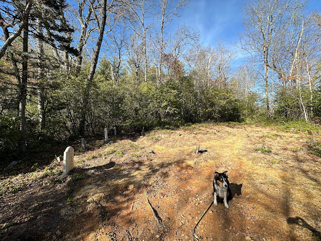
| Many of the graves are from the 1880's. |


No comments:
Post a Comment