| Date | Distance | Time | Elevation Gain | Average Moving Time | Year to Date Miles |
|---|---|---|---|---|---|
| 10/23/2021 | 5.8 miles | 3 hours 6 minutes | 513' | 2.0 | 401.1 |
- National Geographic South Holston and Watauga Lakes, Map 783
- More detailed map download from GaiaGps.com
- Julian Price Park Hiking Trails - Blue Ridge Parkway (U.S. National Park Service) (nps.gov)
Parking: Julian Price Memorial Park picnic area
Directions: From the parking area, head towards the restrooms. Cross a bridge and enter a field. Where the path splits, stay straight on the orange blazed Boone Fork Trail. Follow the trail in a loop, taking a marked side path down to Hebron Falls.
Carolina Mountain Club Challenges:
Directions: From the parking area, head towards the restrooms. Cross a bridge and enter a field. Where the path splits, stay straight on the orange blazed Boone Fork Trail. Follow the trail in a loop, taking a marked side path down to Hebron Falls.
Carolina Mountain Club Challenges:
- 100 Favorite Trails, Hike #96
- Waterfall Challenge, Hebron Falls
Mountains to Sea Trail:
- Segment 5, miles 13.0 -15.7
Krummholz and I headed out to Julian Price Park to do a hike on the Carolina Mountain Club's 100 Favorite Trails Challenge. We drove past Marion, and Linville Falls, and then hopped onto the Blue Ridge Parkway heading north. We passed by Grandfather Mountain. The foliage along this section of the parkway was incredible. Unfortunately, 1,000+ other people thought it was incredible too. Cars were parked everywhere along the edge of the parkway. Cars were stopping on the parkway to take photos. People were sticking their cell phones out their sun roofs taking videos. It was a madhouse. Way too many people for me. I wondered what the parking was like for my hike, since the parkway was so crazy. This hike is a few miles beyond Grandfather Mountain. Turns out this park has loads of parking. The park was crowded, but there was parking not just in parking spaces, but in a field.
I did this loop counter clockwise as recommended by a friend. This would mean I'd pass by the campground first, and leave the more interesting bits towards the end of the hike. The trail around the campground had lots of people. Things quieted down after I left the campground. I thought it was an average hike at first, wondering why it made the 100 Favorite Trails list. Then we started crossing a number of streams. Krummholz was in heaven. He likes wading in streams even more than hiking. I stopped and let him investigate each one. The trail started getting crowded again, and we'd often have to wait for several people as they negotiated the stream crossings. I think some people on the hike found that the hike was more than they were expecting. People wearing cowboy boots, knee high leather boots, very clean white sneakers. They didn't want to get their feet wet. Around half way through the hike, the trail started to parallel the river. We started seeing some cascades. We stopped at one of the bigger ones. We continued on, and found a sign to Hebron Falls. We hiked down. At the bottom there were big boulders that the water wound around. Many people were hopping from boulder to boulder. My joints don't allow me to hop anymore. But we walked around and I let Krummholz wade in some quieter pools of water. We continued on and finished the loop.
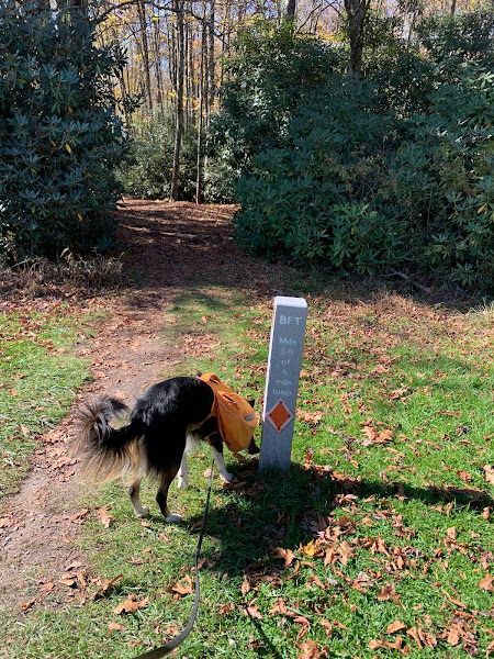
Krummholz liked this hike more than me. Pros: 1) Very well marked trail (orange diamonds), easy to follow. It even has mile markers 2) Krummholz loved all the stream crossings. 3) Often wide trails allowed me to move Krummholz off trail to let other dogs pass. Cons: 1) Too many loud people, too many loud dogs. 2) Hiking in a conga line 3) Traffic during leaf peeping season.


No comments:
Post a Comment