
| Date | Distance | Time | Elevation Gain | Average Moving Time | Year to Date Miles |
|---|---|---|---|---|---|
| 12/28/2017 | miles |
Map: National Geographic Joshua Tree Map
Guide book: Hiking Joshua Tree National Park, a Falcon Guide
Directions: Hike #16 in guide book, Lost Horse Mine Loop
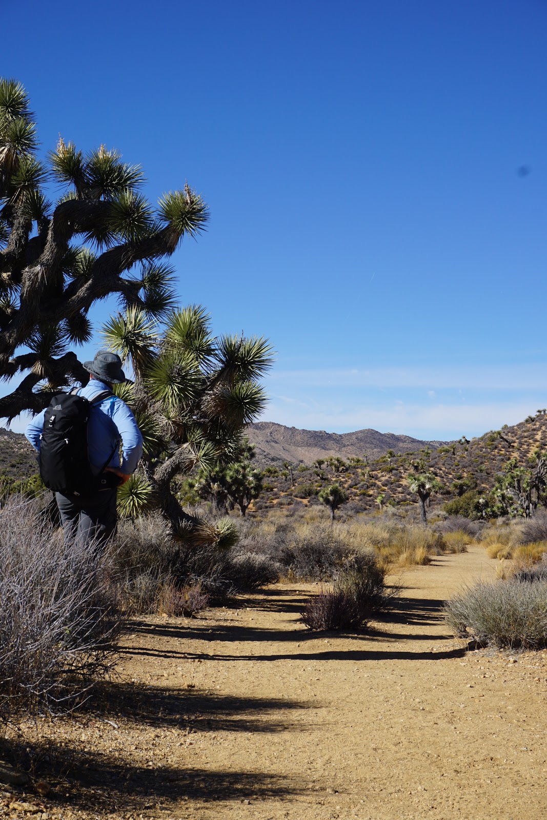
Today we were more prepared. We bought sunglasses! Our first hike of the day was the Lost Horse Mine Loop. It started out chilly. I wore a short sleeve wool shirt, a long sleeve wool shirt, and my puffy. I hate starting out cold, so I tend to overdress. The trailhead didn't have many cars. I decided to pre-hydrate today, and drank 3/4 of a liter on the way to the trail. Then I carried 4 liters. So heavy!
The book said you need cross country navigation skills (they never say bushwhacking) for this hike. I didn't find that to be the case though. The trail was pretty well marked all the way. In general, I found the National Geographic map not detailed enough (it is 1:78), but I don't think there are any more detailed maps unless you use the USGS maps. Since I knew I wanted to do this hike, I created a map using Caltopo, which had so much more detail than the National Geographic map. I came to hate the National Geographic map. I mean, it's great for getting a good understanding of the layout of the park. And it does have most trails. But some trails on the map are not named - yet are named on the trail. And some trails we did weren't on the map. It was frustrating at times. Also, we were interested in some other hikes which said they needed cross country navigation skills, but I felt like I would need a more detailed map in order to navigate using a map and compass. It just might be my lack of confidence in my navigation skills. Some hikes we did were better marked than others. I sort of thought that the trails would be better marked. In general, the markers (usually posts) were few and far between. Trails (usually sand) were lined with rocks when they crossed confusing washes where you might not know which way to go. We did okay, but we did see a few confused people who didn't know where to go.
The terrain on this hike was good - not deep sand. We hiked to Lost Horse Mine and wandered around. Usually the mine shafts we saw were covered over with metal grates to prevent people from going in them. You can climb to the summit above the mine, though we didn't realize it until we had moved on. Some people do the out and back to the mine, but the area just past the mine had phenomenal views for 3/4 of a mile. I really enjoyed this hike.
When we turned around the bend, approximately at the half way point, the views disappeared. The latter part of the hike had a lot of Joshua Trees. We passed an old stone chimney - there were a couple herd paths near it, but we didn't take them too far. The trail continued on a wash again (sandy area). The second half of the hike was physically easier than the first half.
Next up...we tried to unsuccessfully hike Ryan Mountain.


 |
| Burn area |


And some videos...
No comments:
Post a Comment