| Date | Distance | Time | Elevation Gain | Average Moving Time | Year to Date Miles |
|---|---|---|---|---|---|
| 7/22/2021 | 2 miles | 1 hour 41 minutes | 830' | 1.2 | 166.3 |
Parking: Montreat Road, shortly past entry gate, on right side
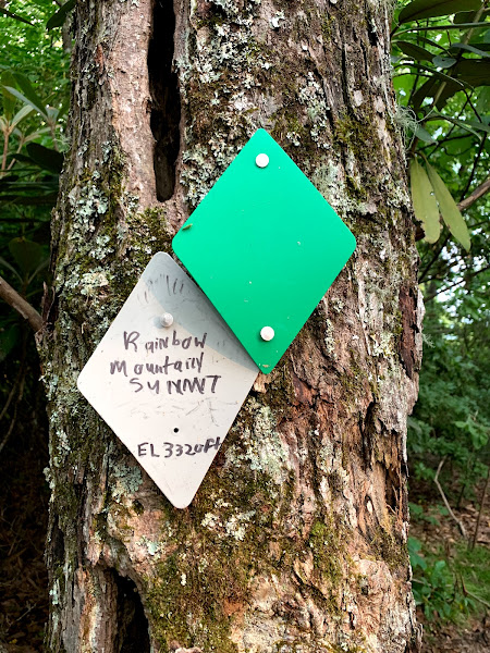
Directions: From parking lot take trail and cross bridge over Creek. We turned left and then started climbing a trail uphill. At this point there was some confusion, as there was a left arrow sign, but according to the map on Gaia we should go right. Oh..and we started heading up to a private house by accident. Eventually we got straightened out and turned right at the left arrow sign. We reached a town service area, and then turned left onto the trail into the woods. I notice on the Montreat online map, though less detailed than Gaia, has a more straightforward way of reaching the Rainbow Mountain Trail. We passed the Rainbow Mountain summit, and reached the Rainbow Mountain loop. At this point we turned around and went back down the same way.
This hike was very hard for me. It was a hot day, and we were 2,000' lower in altitude then we were yesterday. I was wearing long pants, and I was hot. After the service area, the trail is a constant climb. There are tons of switchbacks, but it is very steep. The online map lists it as .63 miles, and most of that 830' gain is in that section. I had to take several rests on the way up. We had wanted to do the loop at the top, but we didn't have enough time before sunset. Going down was slow as well, as I was very careful not to fall. Rainbow Mountain doesn't have a view, but there was a partial view on the way up. The hike did have some cool looking mushrooms. At the end of the hike, we let Krummholz cool off in the creek. And for the humans...we stopped in Black Mountain for ice cream (vegan for Glen) on the way home.


No comments:
Post a Comment