
| Date | Distance | Time | Elevation Gain | Average Moving Time | Year to Date Miles |
|---|---|---|---|---|---|
| 10/7/2017 | 13.1 miles | 6 hours 17 minutes |
Map: Appalachian Trail Guide, New Hampshire-Vermont, plus map that comes with it.
Parking: 1st car: K1 Gondola parking lot in Killington. 2nd car: VT 103.
Directions: Take K1 Gondola up. Take short trail (unmarked) to Killington summit. Return to Gondola. Take C (Catwalk) trail heading down the mountain. When you reach another chairlift, turn left onto an unmarked path. This will reach the Cooper Lodge shelter. Head southbound on the AT to VT 103.
We made a last minute decision to go on a weeklong vacation in Vermont. This spring when we were hiking on the AT in Georgia, we were inspired by the excitement of the new thru hikers starting their journeys. During that trip we decided that we would hike the whole AT. We figured that hiking 200 miles a year on the AT would be reasonable goal for us. I still work, and I also have other areas of the country and abroad I want to hike while I'm still able. This year we finished both the Georgia and Massachusetts sections of the AT. It feels good to complete whole states. Due to work and some dog illnesses, it's been hard to get away for a second hiking vacation this year, so we were no where close to hitting our 200 mile goal. I had originally planned on doing Vermont as weekend backpacking trips, so that we'd gradually get some more backpacking experience that we desperately need. That didn't happen. I decided October was too cold for me to go backpacking, so we stayed in a hotel in Rutland. It was a beautiful time to visit Vermont, but a word of warning - many hotels were fully booked, and hotel prices were expensive due to it being leaf peeping season. We drove up to Vermont and rented a car in Rutland so that we wouldn't need to find someone to shuttle us. We've read that break ins at trailheads are pretty common in Vermont, so we got extra insurance on the car. We had no problems at all though.
On our first day we dropped off one car at VT 103 and then drove to the K1 Gondola. We took Killington Road off of Route 4 and drove to the end where there was a huge parking lot for the gondola. The gondola doesn't operate every day - we checked the dates on the Killington website to make sure we hit it on a day it was open. It costs $15 for a one way ticket up. Our trail map doesn't have a lot of detail for the area. It turns out from the parking lot, there are multiple trails up the mountain, so if we wanted to hike, we could have hiked up in about an hour. We've taken gondolas in Switzerland and enjoyed them, so we decided to go up that way. We had a long hike planned, and it saved us a little time and a lot of energy. When we got to the top, it was pretty foggy. Our AT map really was not useful. There weren't any signs at the top, but we saw a trail going up, so we walked up it to the Killington summit. It wasn't the AT. On the summit, it was very windy and exposed and wet and chilly. There was zero view. There were a lot of leaf peepers on the summit despite the fact that there was nothing to see! We wandered around. A lot. We didn't know where the AT was. No signs. There was a blue blazed trail, but there was no sign saying what it was. There was another trail. Again, no sign saying what it was. Glen tried checking the direction of the blue blazed trail with the compass. Compared it to the map. But it looked like it was going the wrong way. We saw the Bucklin Trail on our map and we considered it might be that. And it was unclear from our map if we would want to go down the Bucklin Trail. My guess is that it was the Bucklin trail, and it would intersect the AT. The trail was extremely steep and had large wet rocks. It would have been pretty treacherous to go down given how wet it was. We went partway down, then back up. We then headed to the lodge near the gondola to see if they had a map. They did have a biking map, but it didn't show the AT! It only showed biking trails. None of which are on my AT map. We headed back to the gondola to ask the employees there how to get to the AT. The first one had no idea. The second one gave us directions, but I wasn't optimistic as she also didn't sound too confident. Her directions did work though! We followed the "C" trail partway down the mountain. When we hit the top of a chairlift, we turned left onto an unmarked trail into the woods. We landed up at the Cooper Lodge and found our white blazes! Phew! I suggest if you take the gondola up, that you try to find a detailed map somewhere (I don't know where).
We had a long hike planned, and had wasted quite a bit of time wandering around lost. Luckily the hike was a pretty gradual downhill all the way down to Route 103. The hike was beautiful with lots of moss and small evergreens. Some sections were woods roads. This hike didn't have much in the way of views, but we both enjoyed it a lot. Further down the mountain we got some fall foliage. In general the footing was very good and nothing was too steep. At least until we got to the last mile. That last mile was hard. We hit a steep downhill rocky gorge. We went ever so slowly so we wouldn't fall. All the rocks were mossy and wet and slippery. I did a bunch of butt scooting over them. We didn't take many photos, as it was a drizzly day. Glen felt really tired at the end, and I felt pretty good. We had to drive back to Killington to get our car. The driving distance between the two parking lots was pretty long (I think about an hour), despite it being just a day hike. We got back late to the hotel and decided to just pick up food from the grocery store for dinner.
 |
| K1 Gondola parking lot in Killington |
 |
| In the gondola (made in Switzerland!) |
 |
| Killington summit photo. Windy and no views. |

 |
| Easy woods road section |
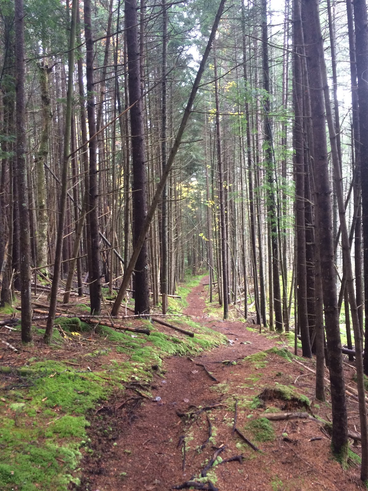 |
| We saw a lot of views like this - moss, pine needles on the trail (my favorite footing), and tall pines |
 |
| A peak of a view |
No comments:
Post a Comment