| Date |
Distance |
Time |
Elevation Gain |
Average Moving Time |
Year to Date Miles |
| 10/14/2017 |
8.1 miles |
4 hours 2 minutes |
1,931' |
|
|
Map: Hampshire-Vermont Appalachian Trail Guide and maps that come with it
Parking: Leave first car at Stony Brook Road. Leave second car in small parking area off of Green Gate Road.
Directions: Take unmarked trail from Green Gate Road for about .4 miles to the AT. Turn right (southbound) onto the AT. Hike to Stony Brook Road. Turn right onto Stony Brook Road and hike to the parking area.
You can see yesterday's post on parking at Stony Brook Road. This time we knew how to get there and knew how far to go to park. I forgot to mention - the road has signs for maximum ATV speed. Like maybe ATV's use it more than cars? We thought of trying to take a backroad (Smith Hill Road) as a shortcut to Green Gate Road, but we never found it (no sign for Smith Hill Road). More on that later. So we took the longer route. From Route 12 we turned onto School House Road, then right onto Green Gate Road. Although they were dirt roads, they were easy to drive on. There are some nice houses in the area.
We hiked uphill on the side trail which leads to the AT. We turned right onto the AT, and reached a side trail for the Lookout. I had heard about this place - a cabin on privately owned land which the owners let hikers visit. Glen hadn't read about the lookout, so he was surprised to come upon such a tall building. There is a ladder to the top of the building, and a small patio area on the roof where you can enjoy the view. What a view! This was certainly a highlight of our Vermont trip. We stepped inside the cabin - its a basic shelter, but 4 sided unlike most AT shelters. We saw a handful of tent sites close by.
We returned to the AT and heard regular gunfire. I guess hunters are practicing for their upcoming deer season. We did not wear blaze orange. We probably should have, though we actually didn't see any other hikers wearing it either. We crossed Chateauguay Road, a dirt road without any parking that we saw. We continued on to where we had ended yesterday at Stony Brook Road. We walked down the woods road to our car.
This time - we had figured out how to take the "shortcut" onto Smith Hill Road. The road sign had a different name, but at some point the road name changed. We were a bit trepidacious about driving down some dirt road we knew nothing about the condition of. But another minivan took it right in front of us. We figured they knew what they were doing. So we took it too! Ha! The road started out okay, and then got more difficult. At some point there was fresh gravel on the trail which hadn't been tamped down, so there were deep ruts. We drove very slowly, hoping not to bottom out. The road of course was mostly a one lane road, so turning around isn't always easy. Then the mini-van we had seen before, passed us going the other way. Hmm. We continued on and reached an absolutely stunning house with a gorgeous view of the mountains. Just wow. Except the "through" road became impassible at their driveway. Not just mildly impassible, but really impassible. ACK. We had to turn around in their driveway and re-drive the bad road we had just came up on. So - don't try to take any shortcuts. You'll need to take Routes 107 and Route 12.
 |
| Parking at Green Gate Road |
 |
| A split in the trail (before the AT). It was unclear which way to go - we went right which worked fine. |
 |
| The intersection with the AT |
 |
| Definitely worth the trip |
 |
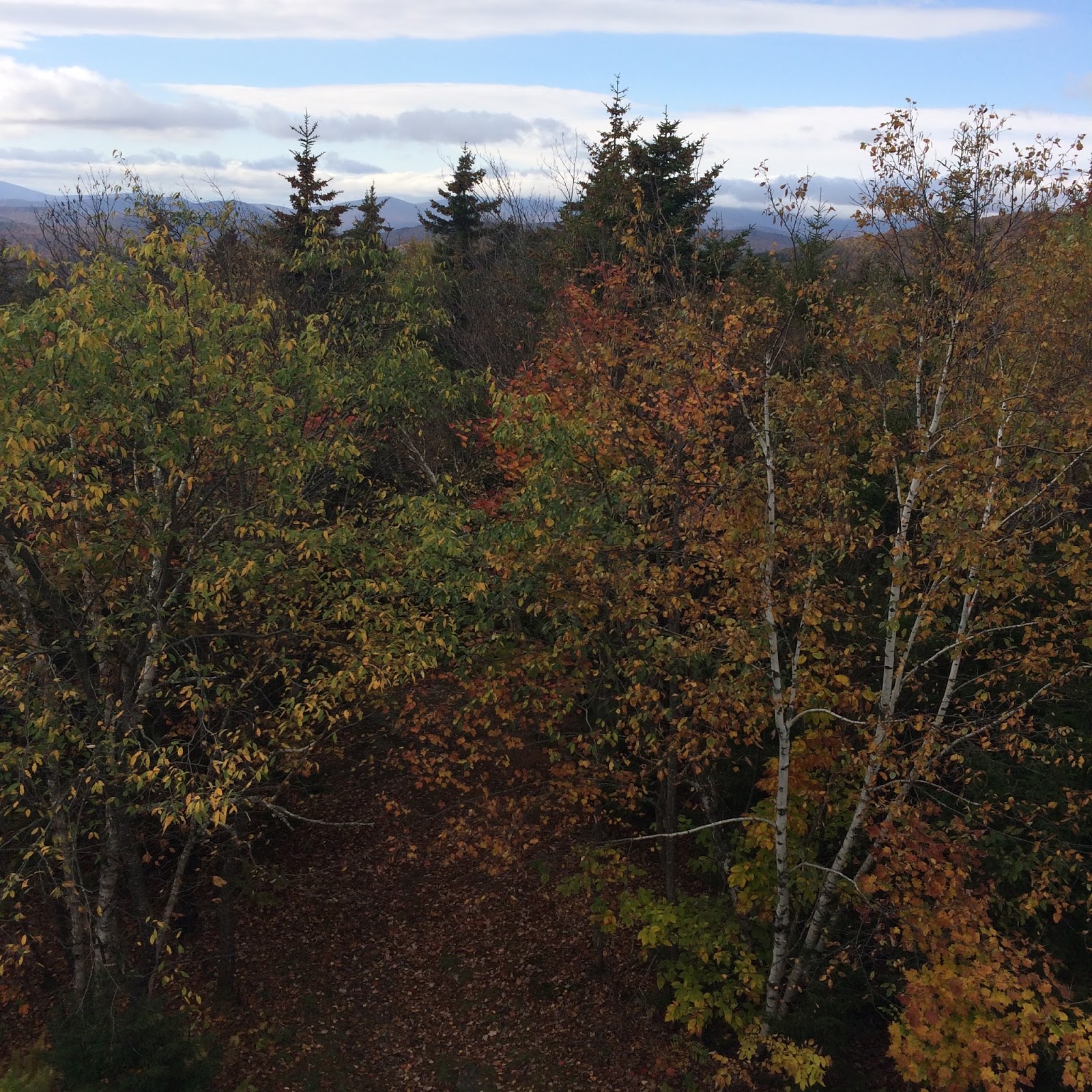
| View from the roof |
 |
| View from the roof |
 |
| Looking down the ladder |
 |
| View from the roof |
 |
| View from the roof |
 |
| View from the roof |
 |
| View from the roof |
 |
| View from the roof |
 |
| The cabin |
 |
| Inside |
 |
| A not so exciting lookout down the trail, mentioned in Guthook |
 |
| Bridge at the intersection with Stony Brook Road |
 |
| Sign near where we parked |
 |
Stony Brook Road
Oops - sorry for turning my camera sideways part way through. Hope you don't get vertigo!
|


No comments:
Post a Comment