
| Date | Distance | Time | Elevation Gain | Average Moving Time | Year to Date Miles |
|---|---|---|---|---|---|
| 2/20/2016 | 9.4 miles | 5 hours 34 minutes | 1,657 | 1.96 mph | 80.6 |
Directions:
From parking lot, turn left on Scutt Road.
Turn left on North Lake Road & look for trailhead on the right side of the road.
Take the yellow blazed Rock Shelter Trail.
Turn left onto red blazed Mary's Glen Trail.
Turn left onto the blue blazed Escarpment Trail.
Hike a short distance to view at North Point.
Continue along the Escarpment Trail.
Arrive at Stoppel Point first view on the right.
Continue to Stoppel Point second view on the left.
Turn around.
Short bushwhack to summit of North Mountain.
Continue to North Point.
At intersection with Mary's Glen Trail, stay left on Escarpment Trail.
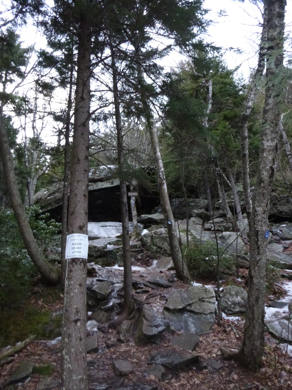
Pass Badman's Cave.
Turn right on yellow blazed Rock Shelter trail.
Turn left onto red blazed Mary's Glen Trail.
Take short yellow blazed spur to trail to Ashley Falls.
Return to the red blazed Mary's Glen Trail and follow it to the road.
Turn right onto the road.
Follow the road past the gatehouse.
Turn left onto Scutt Road and return to parking area.
Notes:
Beautiful spring like weather today. We were both itching to go hiking after spending last weekend indoors due to frigid temperatures. The hike starts out on the Rock Shelter Trail, which we remembered as being very wet. There is a lot of ice on top of water, so you just have to hope that you don't punch through. The worst of the ice passed quickly and we were hiking more on dirt - still with microspikes on. We saw a few other hikers today, presumably going to North Point, and they were barebooting it. We didn't see anyone else wearing microspikes. It was kind of a pain because there were enough icy sections where you want them, but then there were long sections where you didn't need them at all. I enjoyed portions of Mary's Glen Trail - hiking through forests of balsam and birches. Very pretty. We arrived at North Point and were blown away by the wide open view. We heard that this viewpoint is crowded in the summer, and I can see why. Nice view of North South Lake. We continued on, knowing we'd want to do a short bushwhack to the summit of North Mountain. Trek pointed out what he must have thought was a herd path, but we continued on, skipping it (we should trust Trek, he rarely leads us astray). We continued to Stoppel Point. First there is a view on the right. I tried to identify a small mountain we saw - I'm wondering if it was Cairo Round Top. I'll have to check my trail guide. We then continued to a view of Blackhead, Black Dome, and Thomas Cole on the left. There is a plane crash site further on, but we decided it was time to turn around and we'd visit the plane when we hike to Stoppel Point from the north next time. On the way back we chose a point to bushwhack to North Mountain (no herd path). The area is very flat, so we used my GPS to guide us to the approximate summit area. On the way back to the trail, we passed a dead white rabbit. Part of it was spread out, and Trek managed to get a bit before we realized what he was doing. We saw a campfire site during our bushwhack, which seemed kind of odd as there was no trail/herdpath that we saw. We saw some pink tape on a tree branch (guessing from someone bushwhacking) and removed it. Later on, we passed Badman's Cave. We hiked there before recently. This was the most challenging part of the hike. There is a steep climb, and the rocks were covered with a very thin layer of hard black ice. My microspikes weren't gripping at all. We basically hugged trees on the way down. It was fine, just challenging. After that, we did hit more ice flows. I'm much more comfortable hiking up them than hiking down them. Mostly my spikes worked fine. A couple areas we ended up bushwhacking around to avoid them - too steep for spikes, and we had decided not to carry our crampons. We hit the road walk right at sunset. It got dark as we were returning to our parking area, but we were able to easily hike on the road without getting out our headlamps.


 |
| View of North South Lake a little below North Point |
 |
| North Point |
 |
| Trek looking down at North South Lake and the Hudson River |


 |
| Stoppel Point first view |
 |
| Stoppel Point second view |
 |
| On our way back we bushwhacked trying to find actual summit of North Mountain. |
 |
 |
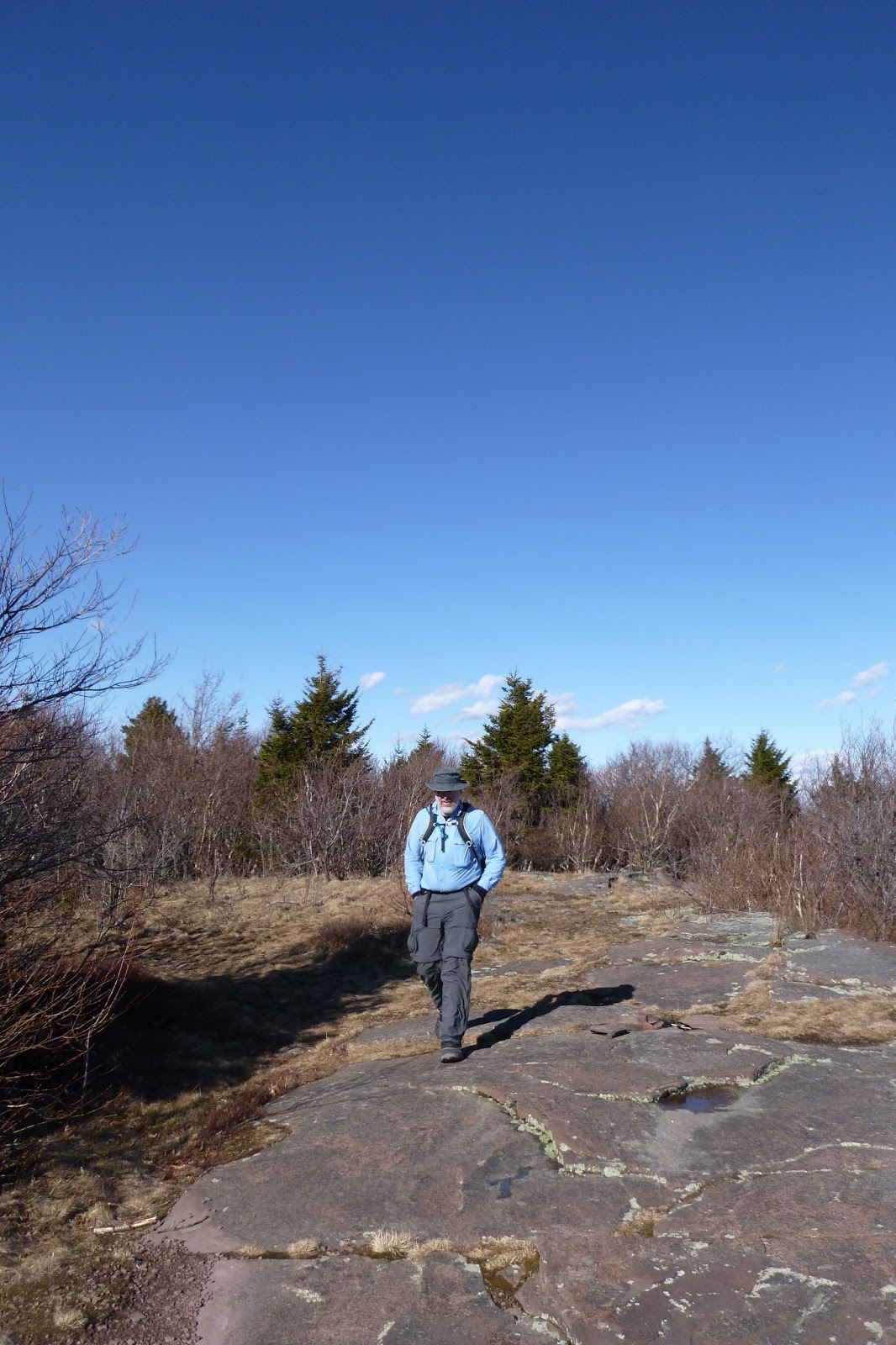
| Pretty open area before our descent to Badman's Cave |
 |
| Black ice covered rocks. Ugh. |
 |
| Hiking on this was actually easier as my spikes had something to bite into. |
 |
| Side view of Ashley Falls |
 |
| Spur trail that takes you to the base of Ashley Falls. |

 |
| Frozen falls, but you can hear the water rushing under the ice. |
 |
| And see the water rushing under where you walk |
 |
| Our parking area is the opposite way of the trailhead parking sign. |
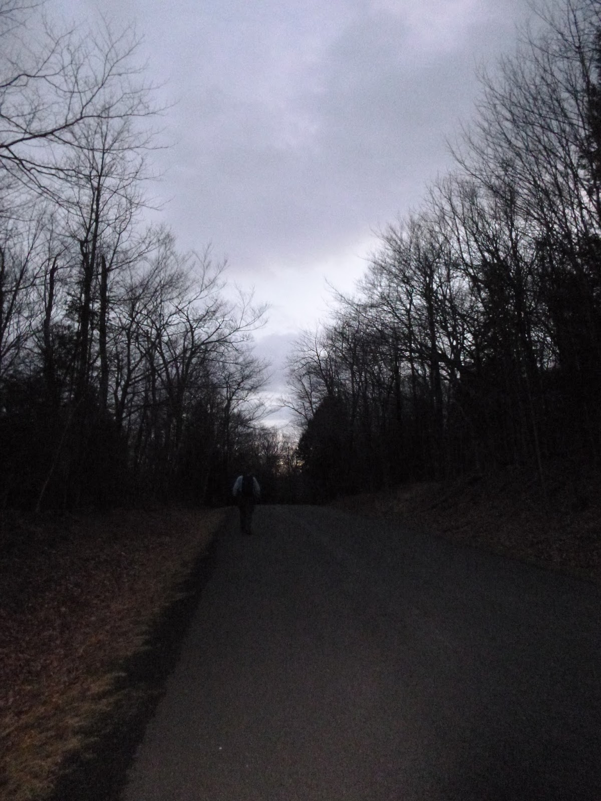 |
| Post-sunset road walking, not so bad. |
No comments:
Post a Comment