
| Date | Distance | Time | Elevation Gain | Average Moving Time | Year to Date Miles |
|---|---|---|---|---|---|
| 2/28/2016 | 4.1 miles | 2 hours 13 minutes | 1,366' | 2.06 mph | N/A |
Trail Map
Parking: 9W
Parking: 9W
Directions:
Take white blazed Bobcat trail. Turn right on blue blazed Howell trail.
Climb to view at North Point.
Continue along Howell trail.
Continue and pass by several views of the Hudson River.
Turn right at woods road for short spur to Pitching Point.
Continue back along Howell trail.
Approach 218.
Turn left just before road and bushwhack a very short distance (crossing 2 streams) to get to the Stillman Spring trail.
Alternatively you could walk down to the road, turn left and then take a left again back into the woods.
Turn left onto the white blazed Stillman Spring trail.
Follow to the end where you hit the Howell trail.
Turn left on the blue blazed Howell trail.
Turn right (more straight) onto the white blazed Bobcat trail.
End at parking area.
Directions for reverse version of hike
Notes:
Glen is injured (treadmill accident), and I just needed to get out of the house, so I headed out to do a hike in Black Rock Forest. As I was driving I noticed several hiking parking lots that were packed. I arrived at the parking area on Mine Hill Road and it was full (and there is no roadside parking there). Ugh. So, I figured out a loop hike in Storm King State Park that I haven't done before and headed south on 9W. Unfortunately the parking area is on the northbound side of 9W, and you can't turn into it when you are driving southbound. So I drove several miles before I could turn around and drive north on 9W. The parking area isn't too big, but it wasn't full. The area was a bit muddy, so I chose a spot that was dry and easy to pull out of. When I left the parking lot was absolutely packed.
The weather was nice today - around 60 degrees. I overdressed as I often do when the weather is starting to get nice. I passed 3 boys wearing shorts who were looking for a geocache. The beginning of the hike has a lot of motorcycle noise from 9W, but you forget about once you hit the first view at North Point. It's a nice place to stop for a break after the short climb to get there. Continuing on you eventually reach several views of the Hudson River and Cold Spring. Once you hit route 218, the rest of the hike is uphill. It's odd to end a hike going uphill. Usually we climb mountains where your uphill is in the first half of the hike. We saw quite a few people out today - everyone out to enjoy the nice weather. A few dogs as well. I almost stopped at North Point again on the way back. I was feeling a little tired and thought it might be nice to take a nap there in the sun.
 |
| Trailhead at parking lot |
 |
| Happy to have some stream crossings |
 |
| Approaching North Point |
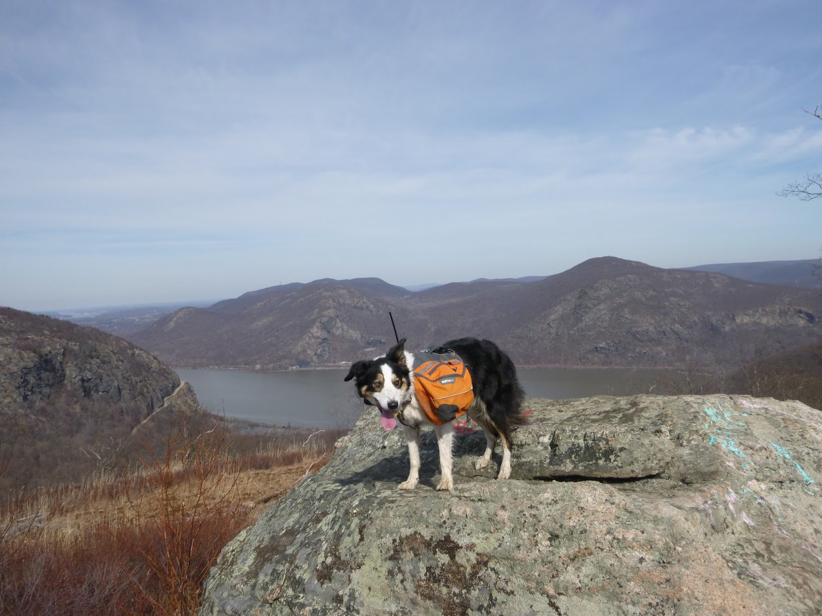 |
| View from North Point |

 |
| More views further on |
 |
| Looking across at the town of Cold Spring |
No comments:
Post a Comment