
December 24, 2013
Miles: 1.0
Time: 1 hour 12 minutes
Parking: Visitor Center at the end of East Ridgecrest Boulevard. There is an $8 parking fee. The road to the trail head is very twisty for many miles!
Time: 1 hour 12 minutes
Parking: Visitor Center at the end of East Ridgecrest Boulevard. There is an $8 parking fee. The road to the trail head is very twisty for many miles!
Rest rooms: In the parking area.
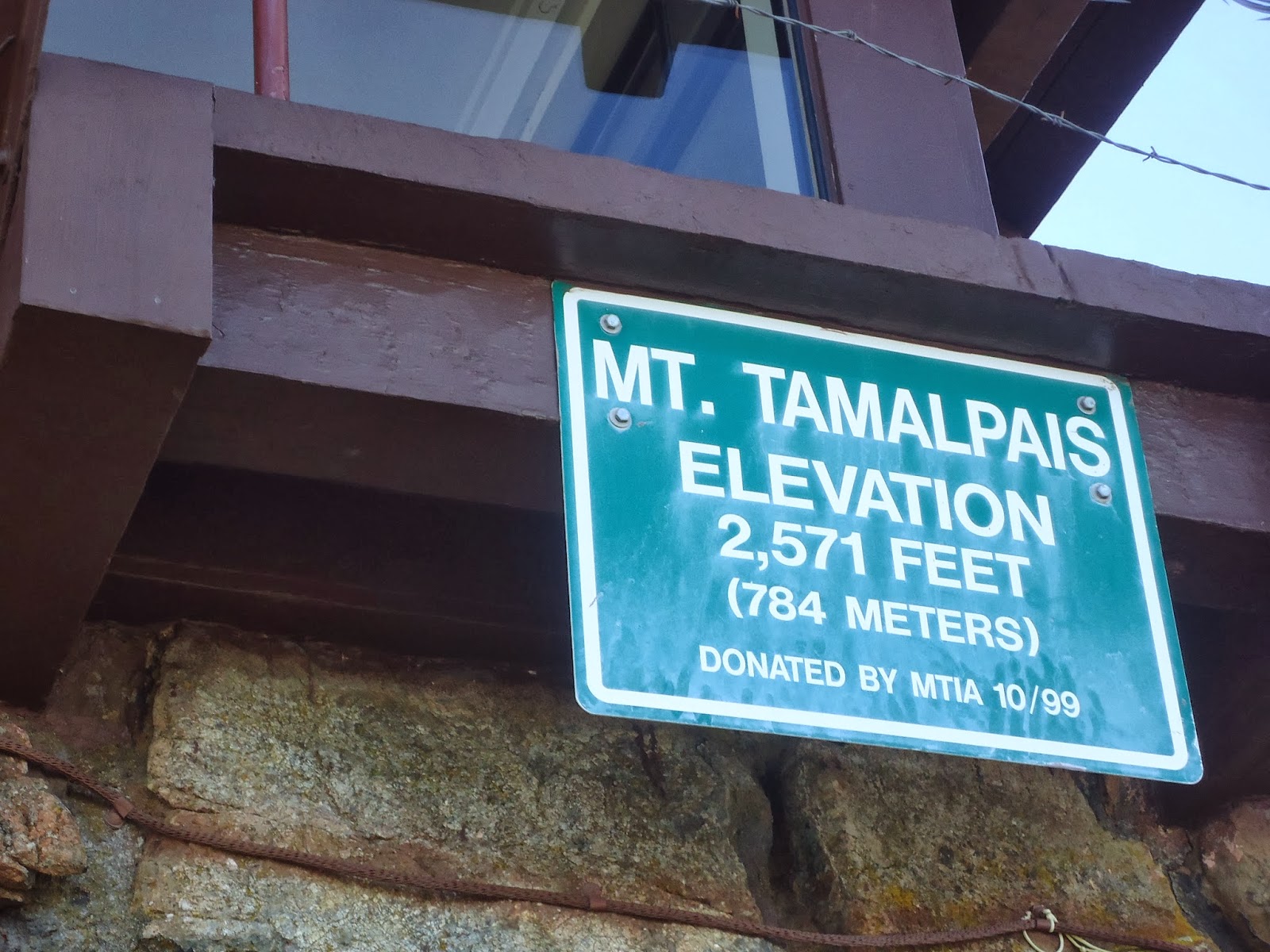
Map: Mount Tamalpais
Hike directions: There is a post at the visitor center that says to the east peak. Just follow this up. There is a tower at the summit, and it is easily visible during the hike. There are no blazes, but it a short obvious trail to the summit. There are several paths around the summit to explore the views in every direction.
Hike directions: There is a post at the visitor center that says to the east peak. Just follow this up. There is a tower at the summit, and it is easily visible during the hike. There are no blazes, but it a short obvious trail to the summit. There are several paths around the summit to explore the views in every direction.
Hike description: This is an out and back hike. The hike starts out on wooden planks, and then becomes very rocky. The summit has beautiful 360 degree views. The summit is above cloud level, with San Francisco in the distance below the clouds, and the tops of mountains above the clouds. I would recommend a foggy day/morning for this hike, as the view during the drive up the road (if you are the driver, you won't be able to look - the drive is super twisty on the edge of the mountain) and the view even just at the parking area is breathtaking.
Year to date miles: 403.3


 |
| This photo needs trimming - Glen was trying to use his hand to adjust the lighting. The view from the drive up and the parking lot was breathtaking. Unfortunately, I was the one driving. I remember looking out once on the way up, and being speechless when I saw the view. |
 |
| San Francisco from Mount Tamalpais. |


 |
| Short hike from the parking area to the summit. It starts out on wood planks. |
 |
| And then turns to dirt and rocks |
 |
| Summit marker |
 |
| Tower on summit (closed when we were there) |
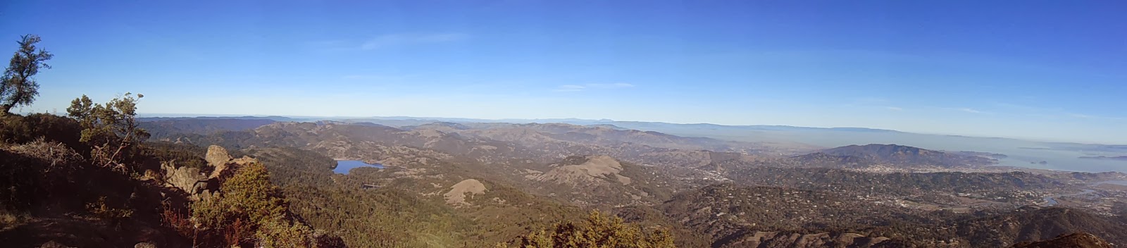 |
| 360 views from the summit |

 |
| Umm...this photo looks kind of funny - like I'm growing twigs from my hair. |


No comments:
Post a Comment