Sunday, August 26, 2012

Black Rock Loop, Harriman

August 26, 2012
Distance: 3.5 miles
Time: 2 hours 16 minutes
Map: Harriman - Bear Mountain Trails - Northern Trail Map 119
Parking: Dirt parking lot on Route 106, west of Kanawauke Circle (4th parking area after circle)
Restrooms: none
Post hike dinner: Jewel of Himalaya, Yorktown

Directions:
Face road from parking lot - the trail is across the street on the left
Follow the White Bar trail (white blazed).
Turn right on the Nurian trail (white blazed - sometimes with N's)
Hike up to Black Rock, which has a good view.
Turn left of the Ramapo-Dunderberg trail (red dot on white).
Pass Bald Rocks shelter on right.
Turn left on the yellow blazed Dunning trail - this turn is easy to miss.
Turn left on the White Bar trail.
Pass by the White Blazed Nurian trail which goes to the left, staying on the White Bar trail.
Continue to parking lot.

Year to date miles 273.4

Parking area
Beginning of the White Bar trail, which parallels the road for a short distance and then veers right
On Black Rock, where there was a large group of Chinese hikers, one singing opera
Leaving Black Rock to go on the Ramapo Dunderburg trail
This section of the trail leaves the woods, and is very scenic
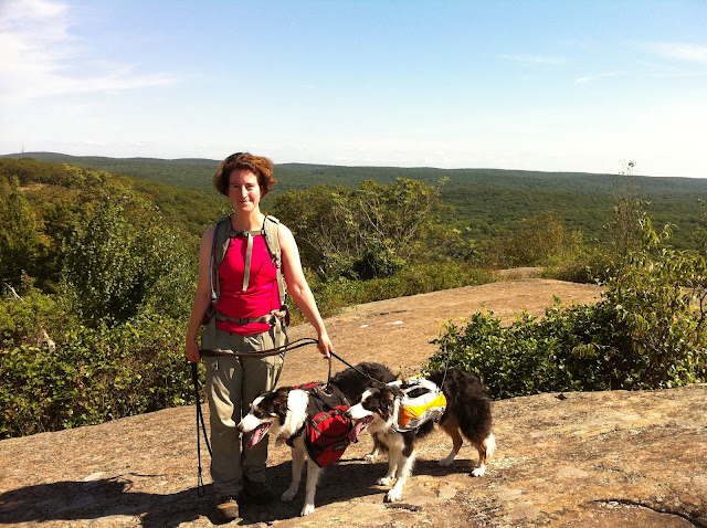
An overlook to the left of the trail. In the distance are hills, not mountains. We used Peakfinder to get their names.
This is one of my favorite sections of Harriman. I believe these are glaciatic boulders.
Bald Rocks Shelter
This cairn marks the turn onto the yellow blazed Dunning trail. It is easy to miss seeing a yellow blaze for the turn.
And here is where we have just turned onto the Dunning trail.

Saturday, August 25, 2012

Iron Mines Short Loop, Harriman

August 25, 2012
Distance: 3.7 miles
Time: 2 hours 20 minutes (including a stop for swimming)
Map: Harriman - Bear Mountain Trails
Parking: Seven Lakes Drive, parking lot next to Lake Skannatati
Restrooms: none
Post hike dinner: Pizza and Pasta, Yorktown Heights
Directions: Iron Mines Short Looop

In the parking lot if you are facing the lake, go to the right side of the parking lot and look for the turquoise blazed Long Path trail which skirts the lake. Take the Long Path to the Times Square intersection. Turn back a few feet and then turn left onto the Arden-Surebridge trail (red hearts on white) to return to the parking lot.

This hike begins between two lakes. We've found that easy access to lakes attracts a lot of non-hikers. As a result, the beginning and end of this hike have a lot of trash & broken glass. We stopped and picked up a gallon worth of glass & garbage near the end of the hike. We saw another man also picking up trash. There are a lot of people fishing on the lake as well. Once the trail leaves the lake, the trash & broken glass go away. It's just the first and last quarter of a mile where you need to be careful of your dogs. The rest of the hike was pleasant, and had some pretty areas. It is considered easy/moderate, and doesn't have much elevation gain.

There were two stream crossings, but one stream was dry.

Year to date miles: 269.9

This is Moxie's new harness. It is RuffWear, like her prior harness, but a different design.
Intersection of Long Path and Dunning trail. Stay on the turquoise blazed Long Path.
Shaft fot the Hogencamp iron mine
Passing the Arden-Surebridge trail - just briefly before arriving at Times Square. After reaching Times Square,
return here and take the red heart on white blazed A-SB trail.
Times Square - an intersection of many trails
The A-SB trail passes the yellow blazed Dunning trail. Stay on the A-SB trail.
Part of the Pine Swamp Mine.
Umm...dogs are supposed to be in a down stay while I check out the mine.
Trek, what are you doing?
Approaching an overlook of the lakes - this is when we start seeing broken glass again.
Overlooking Lake Skannatati, Kanawauke, and Little Long Pond
Turn right here - this intersection gave us trouble in previous years
We turned right before hitting the parking lot, and stopped at the lake to let the dogs swim.
While Glen threw sticks for the dogs, I picked up trash and broken glass.
Lake parking lot - there are a lot of non-hiking visitors fishing at the lake.

Sunday, August 19, 2012

Sleeping Giant State Park, Hamden, CT

August 18, 2012
Distance: 3.8 miles
Time: 1 hour 55 minutes

Map: Sleeping Giant State Park There were also printed black & white copies of the map at the trail head. A color map (as on the website) & a larger copy would be really helpful!

Parking: Parking spots on Chestnut Lane - about enough space for 6 cars. Parking was free here. At the main parking lot, the fee is $10 for out of state visitors.

Restrooms: n/a (I believe there are some at the main parking lot)
Post hike dinner: n/a

Directions:
Hard to describe - I was lost a lot! Even so, it was not hard to re-find yourself.
There were several unmarked trails which added to the confusion.
I didn't do my original planned route - so I ended up improvising, with the goal to pass Hezekiah's knob.

Lots of trails start at this trailhead.
Started at violet trail on the right.
     Pass unmarked trail on left
     Pass red square trail
     Pass unmarked trail
     Violet trail turns left (stay on it), unmarked trail goes right.
     Pass another unmarked trail on the right
Turn left on the blue trail (light blue blazes)
     The blue trail then splits - you can go straight or to the right. We went straight.
     Pass unmarked trail on the left
Turn right on the red square trail
Turn left on the green trail
Turn right on the blue trail
     Arrive at Hezekiah's knob - has a view
     Continue straight passing white trail
     Hike downhill
     Pass yellow/green trail
     Pass orange trail
Turn right on horshoe trail
     Pass yellow trail
     Walk in chestnut grove
     Pass unmarked trail on right
Turn left at Chestnut Lane for brief road walk
     Walk along road (this will take you to the parking area, but I added more trails)
Leave the road and turn left onto the blue trail
Turn right onto the yellow trail
Arrive at parking area.

Notes:
This was an easy/moderate hike. There were no outstanding views. There are around 30 miles of trails in the park. There are so many trails - it makes it easy to form a loop of any distance. On the other hand - there are so many trails - that it is confusing. I carried my map in my hand for the whole hike. It would have been much easier with an enlarged map printed with a color printer! This park is very convenient for doing a post-dog show hike - only 3 miles away from our dog agility trial. I'd like to do a longer hike here at some point when I have more time.

Dogs are not allowed off leash. There was a warning sign about coyotes & pet dogs. That was enough for me to keep Trek on leash. We only crossed one person (with a dog) on the hike, which surprised me since it is in such a populated area.

There were some numbered spots of attractions on the hike - but they are not on the printed map - so aren't good for helping you orient yourself.


A rock scramble on the violet trail
The blue trail leaving the violet trail
These numbered sites are described in a guide on this site: Sleeping Giant Park Association
View at Hezekiah' knob
Trek at Hezekiah's Knob
The horsehoe trail, which passes through a chestnut grove
Sign at the end of the chestnut grove - right before turning onto the street.

Friday, August 3, 2012

Buck Mountain, Adirondacks

July 22, 2012
Distance: 6.5 miles
Time: 4 hours 59 minutes
Map: ADK Trail Map of Adirondack Eastern Region
Parking: Parking lot off road.
Restrooms: n/a
Pre hike breakfast: n/a
Post hike dinner: n/a
Directions: 50 Hikes in the Adirondacks
This is an out and back hike. Follow the yellow blazes.

Notes:
This was a crowded trail.
There were few brook crossings at the beginning of the trail.
We stopped to take advantage of each one - letting the dogs drink.
At some point you leave the brooks, and then there is no water.
It was a hot day - we carried 8 liters of water (plus a water filter which we didn't need) for 2 people & 2 dogs.
This hike has 2,000 feet elevation gain, but it felt moderate. The difficulty was the heat.
Year to date miles: 266.2


Not much water...
Another water break. Nothing deep enough to submerge the dogs in.
Gaining elevation.
Hot Trek
There is a nice spot before the summit with a view behind you. It is not the summit yet.
Continue into the woods.
Summit marker
Wait....we found a second summit marker! Did someone make a mistake?
Feeling good to let my feet breathe. We searched around and found a spot on the summit where we could have
both a view & sit in the shade. View of Lake George.
Moxie
The third summit marker we found!