June 10, 2012
Distance: 7.2 miles
Time: 5:09 hours
Map:
South Taconic Trails or
Mount Everett State Reservation
Parking: Parking lot on small pulloff, off Route 41 - enough for around 7 cars. It was full when we arrived. We tried the Berkshire School (different trailhead - saw no other hikers parking at this large private school, plus the parking across the street looked questionable, plus there would be a lot of walking to the trailhead from there). Ended up going back to our original parking area, where a space opened up.
Restrooms: Composting toilets at a campground, about 1.8 miles from the trailhead.
Directions:
Mt Everett
Race Brook Falls Trail to end. Turn right (north) on AT to summit.
Post hike dinner:
Salsa Fresca, Millerton, NY (no longer in business)
 |
| Trail head |
 |
| The trail crosses this stream 3 times. The dogs were very happy! |
 |
| Mountain laurel at its peak here. In southern NJ yesterday, it was past its peak. |
 |
| Race Brook falls - much prettier in person. About 1 mile from the trail head. |
 |
| Campsite |
 |
| Tent platform |


 |
| Bear box for food |
 |
| The bear box is chained to a tree. |
 |
| A very large cairn |
 |
| View on the way to the summit |
 |
| Taking a breather. Humid day. |
 |
| Krummholz |
 |
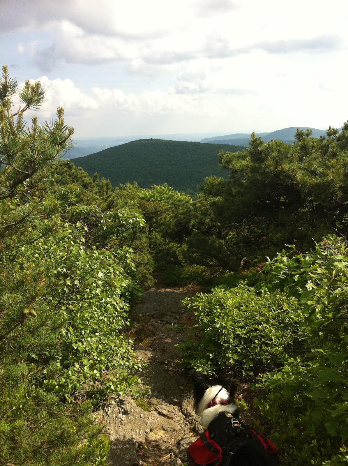
| View of Race Mountain. Saving this one for another day. |
 |
| Mountain laurel |
 |
| Base of a prior fire tower |
 |
| Mt Everett summit marker |
 |
| Limited view from the summit |
 |
| Lynn, Trek, and Moxie, summit photo |
 |
| Glen, summit photo. |
 |
| Moxie on summit |
 |
| Trek, summit - time for a water break |
 |
| View from summit |
 |
| Mount Race |
 |
| Dead luna moth. They only live as adults for 7 days. |
 |
| View on the way down from the summit. |
 |
| Another view of the falls - very pretty in person |
 |
| We tried to take the Lower Falls Loop Trail, but I think we ended up on a herd path - very steep. |

 |
| Mini cairns |
 |
Back at the parking lot
Year to date miles: 197.2
|


No comments:
Post a Comment