Sunday, December 29, 2013

Monument Mountain, Great Barrington, MA

December 29, 2013

Miles: 2.7 miles miles
Time: 1 hour 40 minutes

Parking: Large lot on Route 7 between Stockbridge and Great Barrington. There is a large sign for the parking area.

Rest rooms: None

Hike directions: AMCs Best Hikes in the Berkshires - hike #36

Map: Monument Mountain Trail Map The book also has a sufficient map, and there was a large supply of maps at the trail head. Also, every intersection was well marked, and also had a picture of the map.

Hike description: Short and pretty hike. Moderate. Nice views at the summit and at the Devil's Pulpit. Supposed to be a crowded place to hike, but we didn't meet too many people. Even though the trail map shows different color trails, all of the blazes are light blue.

Year to date miles:   417.2

Sign on Route 7 for the parking area

Map supply at the trail head.

The trail crosses over a stream a few times, and passes by a waterfall (which was mostly frozen today).

Well marked trail intersections

Almost 360 degree views from the summit. I believe that is Butternut ski area in the distance.

Summit view on the other side.


Short out and back to the Devil's Pulpit

Devil's Pulpit


Trail map complete with "You are here" marker. 

Saturday, December 28, 2013

Bald Mountain, Sugarloaf Ridge State Park, CA

December 27, 2013

Miles: 6.8 miles
Time: 3 hours 24 minutes

Parking: Book (and website below) provide GPS coordinates for the parking lot. There is an $8 parking fee.

Rest rooms: In the parking area.

Map: The book provides a map. There were also maps (rough drawn) next to the parking fee area.
This online map is the most clear: Sugarloaf Ridge Map
Hike directions: 60 Hikes within 60 Miles, San Francisco 
Also online at: Sugarloaf Ridge State Park

Hike description: The trails are a combination of pavement, fine gravel, and dirt. This hike is listed as moderate, but we found it strenuous. Hiking poles are recommended, as some of the dirt trails going down are very steep. 360 degree views at the summit, overlooking wine country. The trails are not very crowded. Preferably bring the online map & read the hike description carefully. There was a right turn right before the summit, which felt right, but looked wrong (based on the poor level of detail of the handout map). We saw people behind us also standing at the intersection looking around. Also, descending from the summit, there are multiple trails - the one we had to take was not marked, until we had descended a ways.

Post hike dinner: The Plant Cafe, Burlingame, CA. We love this place! Not vegetarian, but the vegan items on the menu are identified.
This location is about a 12 minute drive from San Francisco airport. It is a bit trendier than the Mill Valley location. It was hopping!
They have craft beers and vegan desserts as well.

Year to date miles:  414.5

This hike is in the Napa/Sonoma area. The drive to the hike passes by tons of wineries.


Trail head at the parking lot. We started on Lower Bald Mountain Trail.

This is a good map of the trail.

We started off on a dirt trail. 

This is a manzanita tree. The limbs on them are beautiful - smooth, red, and twisted.

Mountains under the clouds in the distance. Lots of green here for the end of December!

Bald Mountain trail is paved (it gives access to the microwave tower on Red Mountain).
It keeps climbing uphill, so it is tiring.

At the summit there are signs showing the various mountains you can see in the distance.
We could see Mount Tamalpais, which we hiked earlier in the week.

360 degree view at the summit


Descending from the summit

The descent is on dirt/gravel. It is very steep and we kept sliding.


These we assume are Gray Pines (for which the trail was presumably named).
The pine cones are huge!

The trail passes by an observatory near the end


Driving through Sonoma, there are signs like this everywhere, pointing to various wineries.

Thursday, December 26, 2013

Muir Woods, CA

December 24, 2013

Miles: 4.4
Time: 2 hours 15 minutes

Parking: Visitor Center at Muir Woods. Arrive early! We got super lucky with parking (on a weekday). By the time we left, the parking lots were full, and people were parked for long distances along the road. Entrance fee to get into the park was $7/person.

Rest rooms: In the parking area.

Map: A very small suggested trail is suggested in the park brochure - Muir Woods. When I asked if we were receiving the map (only $1) with our admission, the park attendant suggested we use the map/trail in the brochure. That was a mistake! She suggested that was around a 1.5 hour walk. Well, everyone goes on the main trails!
I also found this: Muir Woods - but I saw others with the $1 park map, and that is much more detailed & useful. I couldn't find the better map online.

Hike directions: None. Try to get off the main trail if you want a more peaceful hike.

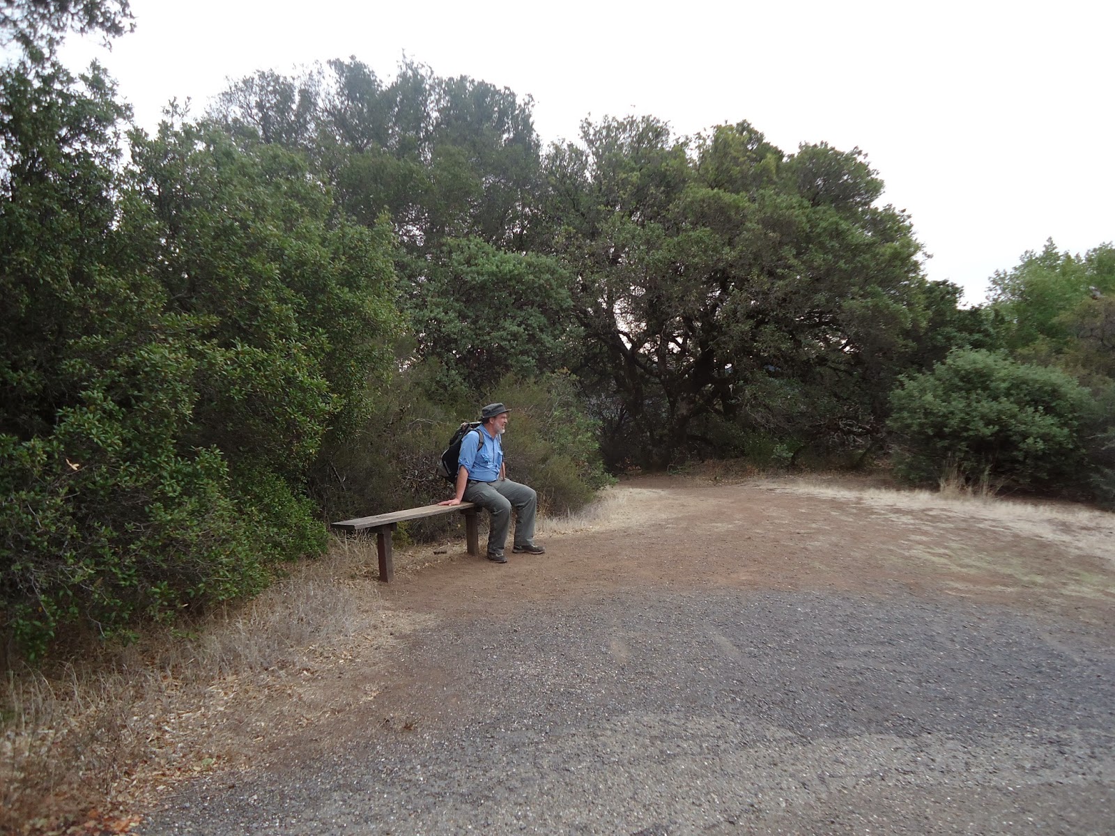
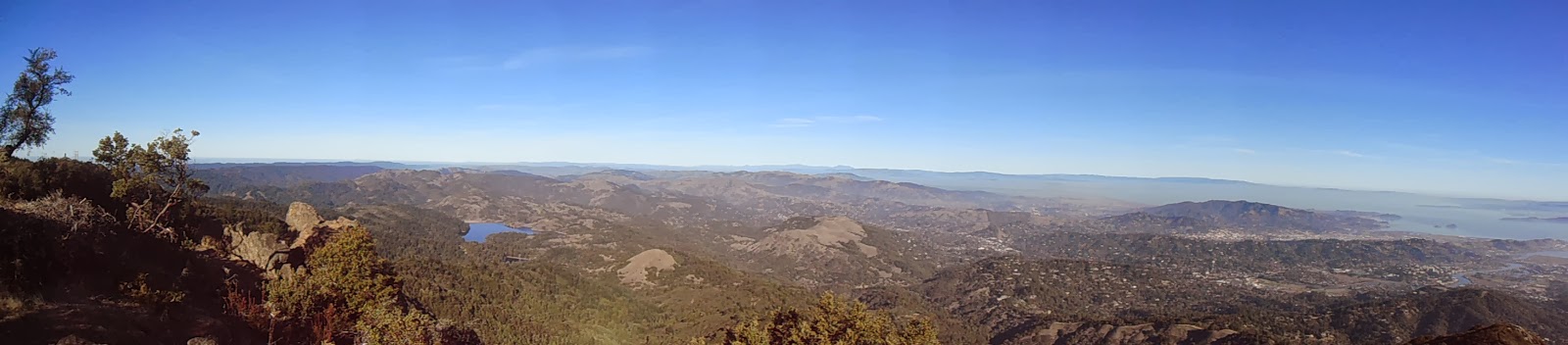
Hike description: I suggest picking up the $1 park map, and planning a hike based on how much time you want to spend there, and how important it is for you to get away from the crowds. We had hoped to hike the Oceanview Trail (less crowded), but that trail as well as the Bootjack trail were closed. The main trails are paved and horribly crowded. You walk very slowly, because there are crowds of people. It is very noisy, and half the people aren't looking where they are going, because they are looking at their cell phones. There was even a "quiet" area on the main trail, but it was far from quiet (their signs had no effect). We took a photo of the park map that was posted on the trail. We then left the main trail and went on the more strenuous, non-paved trails. This was much more peaceful, as there were few people on these.

Post hike dinner: The Plant Cafe, Mill Valley, CA (north of the Golden Gate bridge). This location is more casual than the Burlingame location. You order your food at a counter. This restaurant is not vegetarian, but clearly lists vegan items on their menu. All of the food was delicious.

Year to date miles:  407.7

Entrance to Muir Woods


This is part of the $1 map we should have bought!
We worked on getting off the main trail to try to get some peace.

We headed off to the Fern Creek trail.
It is good to have a map, because once we got off the main trails, there were sometimes unmarked side trails.
We ended up using a photo of the map in combination with our GPS to make sure we didn't get lost!
The smaller trails aren't blazed, though most intersections have signs.
Of course, if you stay on the main trail - navigation is easy, and there are maps at intersections.


View of younger redwoods


Whoa!

A peaceful trail away from the throngs of tourists

Walking on a redwood.

Mount Tamalpais East Peak, Mount Tamalpais State Park

December 24, 2013

Miles: 1.0
Time: 1 hour 12 minutes

Parking: Visitor Center at the end of East Ridgecrest Boulevard. There is an $8 parking fee. The road to the trail head is very twisty for many miles!

Rest rooms: In the parking area.

Map: Mount Tamalpais
Hike directions: There is a post at the visitor center that says to the east peak. Just follow this up. There is a tower at the summit, and it is easily visible during the hike. There are no blazes, but it a short obvious trail to the summit. There are several paths around the summit to explore the views in every direction.

Hike description: This is an out and back hike. The hike starts out on wooden planks, and then becomes very rocky. The summit has beautiful 360 degree views. The summit is above cloud level, with San Francisco in the distance below the clouds, and the tops of mountains above the clouds. I would recommend a foggy day/morning for this hike, as the view during the drive up the road (if you are the driver, you won't be able to look - the drive is super twisty on the edge of the mountain) and the view even just at the parking area is breathtaking. 

Year to date miles:  403.3

This photo needs trimming - Glen was trying to use his hand to adjust the lighting.
The view from the drive up and the parking lot was breathtaking.
Unfortunately, I was the one driving.
I remember looking out once on the way up, and being speechless when I saw the view.

San Francisco from Mount Tamalpais.


Short hike from the parking area to the summit.
It starts out on wood planks.

And then turns to dirt and rocks

Summit marker

Tower on summit (closed when we were there)

360 views from the summit


Umm...this photo looks kind of funny - like I'm growing twigs from my hair.