Sunday, September 29, 2013

Black Rock Mountain, Black Rock Forest

September 29, 2013
Distance: 5 miles
Time: 2 hours 41 minutes
Map: West Hudson Trails Map
Parking: From route 9W southbound, turn right onto Reservoir Road.Take right at T intersection. Follow to Black Rock Park. Parking area with room for around 15 cars.
Restrooms: none
Post hike dinner: n/a
Directions: Black Rock Mountain Circuit Via Footpaths and Woods Roads

Notes: The hike passes Aleck Meadow Reservoir (no swimming), which looked beautiful with the fall foliage. Nice views on Black Rock Mountain. Hulse Road is a gravel road, a little rough to walk on.

Year to to date miles: 306.2


Kiosk next to parking area. $2 per person donation suggested. We donated $5 (dogs are cheap!).


Large pipe crossing the stream. Turn right at the pipe.

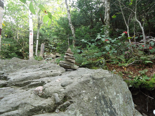
Number on rock just after turning right at the pipe.

Pretty "pipeline" trail. Unblazed, but easy to follow. 
A view on the unblazed trail.

Approaching the reservoir. Turn right. 
Reflections in the reservoir. The dogs were disappointed we didn't let them swim. 
View from Black Rock Mountain.
The dogs entertained two young boys on the mountain who had a million questions about them.

Summit

Turning onto Hulse Road, which gets very gravelly (is that a word??)

Sunday, September 22, 2013

Slide Mountain, Catskills

September 22, 2013
Distance: 5.7 miles 
Time: 3 hours 35 minutes
Map: Catskill Trails Map Set

Parking: See Directions.
Notes: Catskill 3500 footers #22
Post hike dinner: Jaipore, Brewster, NY (no where near the hike!)
Directions: Slide Mountain (west access)

This is a moderate hike. The incline is never too difficult. The hardest part for me was just the typical rocky footing in parts. We found plenty of water for the dogs.

There is a small cutout view before the summit. At the summit there are footings from a fire tower. Just past the summit is a large flat area with somewhat obstructed views, but still pretty nonetheless. Below the large flat area is the John Burroughs plaque.

Year to date miles 301.2

Parking area (pretty full when we arrived) and trail register.

Leaves starting to show some yellow color

Sign at the top of some stone steps for the right turn onto a woods road

Leaving the level woods road for the climb up Slide.

The rocky footing sometimes makes for slow going, especially downhill.


Pass the blue blazed trail on the right. This trail can be used to make a longer loop hike, which I hope to do some day.


View from ledge before the summit. The photo looks pretty washed out, but there is some color down there!


View a short distance past the Slide summit. A good spot to take a break.


Waiting for Glen....


Saturday, September 21, 2013

Wittenberg Mountain and Cornell Mountain, Catskills

September 20, 2013
Distance: 9.8 miles
Time: 7 hours 30 minutes
Map: Catskill Trails Map Set

Parking: See Directions. The DEC parking lot is on the right. Drive past it a short ways (pass the recycling center) to the Woodland Valley Campground office on the left. Pay $6 for parking. Return to the DEC parking lot.
Restrooms: There are restrooms in a building right across the street from the parking area.
Notes: Catskill 3500 footers #20 & #21
Post hike dinner: Garden Cafe on the Green, Woodstock, NY

Directions: Wittenberg Mountain - Cornell Mountain from Woodland Valley 
To get to the start of the hike, cross the street (towards the bathroom). There is a sign that says trail to the left. Walk along the street for a few yards, and you will reach a sign for the trail (red blazed). Follow the trail briefly through a campground area, and turn left before the river. Cross the river on a bridge. Continue following the red blazes for the rest of the hike. Follow the blazes carefully. In one spot, we ended up going off trail accidentally on what I guess was a herd path.

Notes: This was a long, difficult hike. The beginning has a tiring uphill climb. Just when you wonder why you are doing this, it levels out a bit and gets easier. Then there are additional difficult sections later on - luckily by that time our muscles were more warmed up. This hike requires a lot of rock scrambling.


There is limited water on this hike. Make sure to bring enough for you and your dogs. 

This is a difficult hike for dogs. We have harnesses on our dogs, and they were invaluable in helping them scramble up rocks. Our dogs couldn't do the Cornell Crack (a place where humans have to shimmy up a crack). It turns out this is not difficult for humans, but there was no way my dogs could do it. We bushwhacked to the left of the crack, following the bottom of the ledge, until we found a way up. We found an easy way up (no trail), and hit the trail at the top. We put a stick on the trail to temporarily mark the spot, so we could find our turn off point to go back down (turns out one of our dogs could find it anyways). We turned left onto the trail. The trail split left and straight (main trail). We turned left to reach the summit of Cornell which has an overgrown view. We returned to the trail and went straight to get another view before turning around. You might want to consider using boots on your dogs due to the amount of rock scrambling there is (if they slip while scrambling, their pads can easily get cut).


Wittenberg's summit has a great view with a nice large area for sitting. It is supposed to be a crowded summit on weekends. Hiking on a weekday, there were only 2 other people on the summit while we were there.

Year to date miles 295.5


Parking area 
Across the street from the parking area. Restroom building on the right. 
Turn off the road onto the trail. You start out in a tenting area.

After this bridge, you start climbing.

At around 2.5 miles, the trail splits. Follow the red trail. 

This was one of the harder rock scrambles for the dogs. They both needed help getting up this one.

View from Wittenberg. Kind of a hazy day.

Taking a lunch break


Another difficult climb for the dogs

The Cornell Crack. From this perspective it looks like nothing!
But the top of the crack is tall and narrow and requires a human to shimmy up it.
There is also only a narrow spot to stand on below the crack.
We got the dogs up that far, and then decided there was no way they could get up the crack.

View on red trail just past Cornell Mountain's summit

View from actual Cornell Mountain's summit

Getting tangled up in dog leashes with branches in my hair. 

Monday, September 16, 2013

Indian Head and Twin mountains, Catskills

September 15, 2013
Distance: approx. 7.5 miles
Time: 6 hours 25 minutes
Map: Catskill Trails Map Set

Parking: Room for around 20 cars at the end of Prediger Road. The parking lot was packed when we arrived. We were the last ones to leave. Note - Platte Clove Road - my books I have recommend not coming from one approach. 
Restrooms: None
Notes: Catskill 3500 footers #18 & 19
Post hike dinner: Chipotle, Kingston

Directions: Take the Devil's Path (red) for 0.2 miles. Turn right on the Jimmy Dolan Notch trail (blue) and follow to it's end at the notch. Turn left on the Devil's Path (red) and hike up to Indian Head (no view). Continue a short ways past the summit to get a view. Return to the notch, and continue straight (still on the Devil's Path) and start hiking towards Twin. A viewpoint will be on your left (ledge). You will arrive at the first of Twin's summits (large rock slabs, fabulous view). Continue on until you reach the second of Twin's summits (another great view). Return to the notch. Take the trail to the right behind the notch sign. Walk past the stone sofas, and go down to a view on a narrow ledge (be careful!). Return to the notch sign. Take the trail to the left behind the notch sign and hike to the view. Return to the notch sign. Return on the Jimmy Dolan Notch trail (blue). Turn left on the Devil's Path (red) and continue 0.2 miles to the parking area.

Notes:

Year to date miles 285.7


Sign at the trailhead. Start out on the Devil's Path (red) for 0.2 miles.

Turn right onto the Jimmy Dolan Notch Trail (blue). This trail starts out pretty level, but has a steep climb at the end.


At the end of the Jimmy Dolan Notch trail, we turned left first onto the Devil's Path to hike up Indian Head Mountain. After completing that summit, we came back to this intersection and headed to Twin Mountain. After completing that summit, we came back here and went to see the notch view (behind this sign). Then we returned on the Jimmy Dolan Notch trail to the car.

On the way up Indian Head on the Devil's Path.

3500 foot sign, not far to go.


The Twin summit is wooded, so we continued a little ways past it to get a view before returning


There was no summit sign, but we noticed an X on a rock which appeared to be the summit.

We tried to get a photo of each of us having a foot on the summit. Moxie said the didn't want to stand so close to Trek, so we only got 3 of us.

The Devil's Path has a lot of rock climbing. It is tiring stuff.


3500 foot sign on the way up to Twin

There is a ledge shortly before the first summit. Looking out to Indian Head where we just came down from.

Panoramic view - the first of Twin's two summits. This was my favorite one. Beautiful panoramic view and rock slabs at the top.


I wanted to take a nap here. Moxie wanted to play with sticks.


Continuing to Twin's second summit. Mostly a ridge walk, but still some rock climbing. 

Twin's second summit.


Back on the first summit - Moxie still wanting someone to throw twigs for her.

Returning to the notch. There is an unmarked trail to the right behind this sign (shown in photo), and another to the left behind this sign (not shown).

First we took the trail to the right, and came across this cooking area, with two stone couches.

The trail ends at a teeny outlook with a steep dropoff. View of the notch ahead.

Another view of the notch to the right.

We returned to the sign, then took the trail to the left of the sign.

Another view of the notch.