We traveled to Iceland this summer, and had an unbelievable vacation. Here are some things we wished we knew ahead of time - of course by not knowing, it added to the adventure!
Laundry:
Laundromats are very rare in Iceland. Don't expect to find one to do your laundry. It's best to ask ahead of time where you are staying to see if they have laundry facilities that guests can use. Two of the places we stayed were hostels. The hostels let the guests do laundry (for a fee), but there might be only one washer and one dryer, so you might need to wait. The laundry facilities also might not work well :) The first hostel we stayed at - they dryer was broken. The second hostel we stayed at - they charged us to use the dryer, but it didn't dry clothes.
Clothing:
I really had no idea what to expect for the weather, even though I did read about the weather. What we found was that the weather was in the upper 40's to low 50's.
I brought a rain coat which I use as my outer shell. I wore that almost all of the time when hiking. It protected me from the wind and rain. A few days were sunny, and I could just hike in a long sleeve shirt.
I brought 2 fleeces. 1 would have been okay, but it was nice to have one that wasn't sweaty.
I didn't bring enough shirts. This would have helped with the laundry problem. I brought 2 short sleeve shirts - which weren't needed. I brought 4 long sleeve shirts I think - which wasn't enough based on the fact that it was hard to do laundry. I wore each shirt twice before doing laundry, which was okay - but we were there for 2 weeks. All of my shirts were synthetic. Since we often didn't have our own bathroom, and often didn't stay in the same place multiple days - washing in the sink and hanging up doesn't work great unless your shirt dries very quickly.
I brought too many pants. 1 pair of jeans and 3 pairs of hiking pants. I should have just had 1 pair of jeans and 1 pair of hiking pants. Since we were hiking all of the time, and not going to any fancy restaurants, this would have been fine. I only wore 1 pair of hiking pants in the end - which was a warmer pair. I thought I might need long underwear, but I didn't. However, I brought rain pants, which were invaluable. In the west, we had bitter cold weather due to the wind. The rain pants were used for wind protection. In the south, we had lots of rain.
I didn't bring enough hiking socks. Again the laundry thing.
I brought hiking boots, crocs, and town shoes. I could have done without the town shoes. I think I wore them once. The crocs were useful - for using in common shower areas, stream crossings (not that we had many), and of course the hot spring.
I brought a fleece hat which I wore a lot! We had a lot of wind - and I used it mostly to keep the wind out of my face.
I only brought 1 pair of light gloves. We ended up buying extra mittens at a woolen shop in Vik. We were hiking in the rain a lot, and my gloves just weren't drying out. So, 1 pair was not enough.
A bathing suit is recommended too, either to swim in the many, many pools around the country, or to soak in a hot spring. Bikinis are easier to hike in, if you decide to hike in your bathing suit. Trust me on that one.
Navigating:
There is one main paved ring road around Iceland called Route 1. Many people on their trip to Iceland to a loop around the road, which sounds like a fine idea (we didn't). Once out of the main cities (e.g. Reykjavik, Selfoss, for example), there are very small towns. You don't really need to know road names or street numbers. When you get to the farming areas, I don't think places have street numbers. Sometimes you'll see a sign with a map at intersections of Route 1 and other roads...i.e. here is the one or two streets that make up this town, and here are the names of the farms there. It was easy to find places. We bought an Iceland Road Guide book when we were there. I wished we had gotten it ahead of time.
Getting around:
Some people hitchhike/take a bus around the country. Hitchhiking is very common here, and is considered safe. It would be much cheaper than renting a car. However, I would hate to stand by the road for two hours in the rain, trying to find someone to pick me up.
There is a bus that goes around the ring road, and you can get on and off. If it stops where you want to go, great.
Some people don't rent cars, but take day trips from various towns on tour buses. There are tons of these.
Then there are people who rent RV's and drive around that way, staying at campsites. I kind of liked this idea - because it offered more flexibility on where you stay.
Then there people like us who rent cars.
Driving:
ACK. So, I didn't like driving in Iceland. The ring road is fine. The only unpaved parts were brief (road construction). Our guidebook hinted that unless you are going into the interior, all you need is a regular car. Renting cars is really expensive in Iceland. So we got a Corolla. More expensive options are 4 wheel drive cars, and higher clearance 4x4s. So, I really wish we had a higher clearance car. At least a 4 wheel drive car. There are "F" roads in Iceland which require a 4x4. We were fine, not driving on "F" roads. But, even for the regular gravel roads, we would have liked something nicer than a Corolla. We ended up hitting the bottom of our car on gravel at least twice. And backing into a rock. Now you know why renting cars is expensive!
You WILL want to drive on gravel roads. A lot of sites - you need to get off that nice ring road, and go on gravel. The gravel roads - some are fine. They don't have guard rails. They often have drop offs - sometimes 3 feet, sometimes 100 feet. Often they are narrow. And it is hard for two cars to pass by each other going in opposite directions. And they have large pot holes and sometimes grooves. And sometimes big rocks. I was amazed we didn't get a flat tire. There are sheep that are in the roads. They tend to run off when you approach, but you just have to look out for them. Some of the gravel roads had blind curves with a steep drop off on the side, and no room for two cars. ACK. People with 4x4's drove faster than I did. Theoretically you could drive 80km/hour on some of these gravel roads. Really? Not me. If I go again, I'll get a different car. Oh yeah, gravel insurance - a must!
In the country you will come across one lane bridges. People take turns crossing them. Some are really short. Some are very long - with pull off spots on the bridge in case you come across someone coming the opposite direction - you can't always see that far when you start on the bridge. On occasion, tourists will park on the pull off spots to take photos. Some people might have issues with vertigo on the long one lane bridges. They go over rapid rivers I guess you would call them. Very, very fast moving water.
Speaking of tourists. So Iceland is beautiful, and you find yourself wanting to take photos everywhere. It is illegal to park off of the road if there isn't parking (e.g. no parking in the lava field next to the road). You have to be careful of tourists! They will just park on the ring road, get out of their car, and start taking photos - sometimes in the middle of the road, unaware that you are heading towards them at 90km/hour. This happens a lot! People see a view and just stop in the highway.
We didn't have much trouble with understanding road signs. Most have pictures that you can figure out. Mostly you want to study whatever map you are using for driving - and understand how the document "F" roads or "tracks". I don't know the difference between an F road and a track, but you shouldn't be driving on them with a normal car! Malbik endar - pavement ends. Very important - you need to slow down so you keep control of your car.
I only saw 3 stop signs in Iceland. In the cities, there were traffic lights or traffic circles. In the country there were just yield signs where in the US you would have had a stop sign. There aren't tons of cars, so this is fine.
Gas
We had so much trouble the first time we tried to get gas! We couldn't figure it out. Another tourist tried to help us, but couldn't figure out why either. We tried 3 or 4 stations before giving up. So, it turns out that gas stations in Iceland require a pin number for your credit card. U.S. credit cards don't have pin numbers. So, our credit card didn't work. Not all gas stations have attendants. Some are just pumps with no building.
The solution - either always buy gas at stations that have attendants when someone is there. If the station has an attendant, you can go inside, tell them you don't have a pin number for your credit card, and pay inside with your card (or pay cash). But, that isn't a good idea. Because you might need gas at other times, and things close early! Or you might be driving in an area for a long time with no manned stations. The better idea is to buy a gas card from an N1 station (a manned one of course). You can buy them in various increments. Then you can go to any N1 station (they are common) and just use the card.
Gas is expensive. Estimating about $10/gallon. It is sold by the liter.
Money:
One hostel accepted cash only. Other than that, we used our credit card for almost everything. I think I converted around $100 into Icelandic Kronur at the U.S. airport before leaving. I didn't end up spending it all. To get a very rough estimate of costs - we would take the kronur amount and move the decimal over 2 digits to the left. i.e. we thought of Kronur as cents. Not exact, but it gave us some clue as to what we were paying.
Lodging:
We booked our lodging 3 months in advance. That was late. Especially for hostels & guesthouses. Many places were booked. I had to plan our trip around where we could stay. Which meant we did more driving back and forth than we would have liked. I was hoping we could stay in just 3 places and just spend a lot of time in those places. But, that didn't happen. I think the Iceland Road Guide might have helped with more lodging ideas.
We stayed at 2 hostels. If you stay at the hostels, read the online reviews - they are helpful. Hostels have the advantage of kitchens and theoretically laundry. We had a private room in each hostel. Book early for hostels. They are still pretty expensive (at least the private rooms), but cheaper than guesthouses/hotels. The shared kitchen is a nice way to meet other travelers compared to other lodging. Many hostels you will have a shared bathroom, even if you have a private room.
We stayed at guesthouses as well. Most actually had some cooking facilities - either right in the room or in a shared kitchen. So ask! Even guesthouses - it is not uncommon to have a shared bathroom. They all served breakfast - sometimes included, sometimes for a fee. Sometimes the breakfast was more of a restaurant style, sometimes a shared table with all of the guests in the owner's house. Some of them were very expensive, some moderate. The rooms were not large. Sometimes downright tiny.
We also stayed in a couple of hotels. One was an inexpensive hotel near the airport. Cheerless. One was an expensive hotel because we needed a room (but was very nice, quiet, modern, comfortable). But, the expensive hotel didn't make me feel like I was on an adventure for sure!
Advice - book early!
Eating
In the city, there are many restaurants. And, even vegetarian friendly restaurants. We ate at Glo before we left - yeah, vegetables! But, check restaurant hours. Glo closed at 5pm on Saturdays, and wasn't open on Sundays. However we checked out a pool (very, very popular in Iceland), and it was open 8am to 8pm. Swimming more popular than going out to eat?
When you leave the city, eating out is hard for vegetarians. We stayed in one town, Stykkisholmur - no vegan food available in restaurants. And almost no vegetarian food. Really? We brought a backpacking stove (JetBoil) which worked out great. It is easy to find fuel for them at gas stations. One can lasted the whole trip. We brought ramen noodles and dehydrated vegetable soups. We picked up a large water bottle, and just kept it filled every day, so that whenever we were hungry, we could stop and cook somewhere. Restaurants - popular foods are hamburgers, hot dogs, whale, puffin, sheep, we even saw horse. Pizza is moderately common too.
Breakfasts - tended to be bread, Swedish rye crackers, jams, sliced cucumbers, sliced tomatoes, sliced cheese, sliced meat, sliced bananas, sliced oranges, yogurt, muesli, milks of various types, coffee, juices. I've never seen so many sliced bananas (in their skin) in my life. We never had the option of a whole piece of fruit. It seems like they have lots of kinds of milk, including yogurt from milk containers.
Beer - most we tried tasted bad to me, but we did find two that I liked. It was expensive. Look for "VinBudin" stores. Gas stations often had beer too - but only the bad kind.
Some towns have only one place to eat.
The larger towns have big grocery stores. In the country, you might only find a small store with a tiny produce area. Produce is expensive. Selfoss had large stores. We bought bread, peanut butter, chocolates, extra oatmeal, and lots of biscuits/cookies. We often just ate biscuits/cookies for lunch while we were driving/hiking.
I think all vegetables sold in grocery stores are either imported or grown in greenhouses. Thus vegetables are expensive.
Things to do:
So we only planned hikes. We should have pre-planned other options besides hiking. Due to the rain. After a few days of rain, you might want to be indoors. It kind of sucks when you have no hotel to go to (because you aren't staying in the same place), and you are tired of hiking in the rain, and you aren't sure what to do. There is a lot of outdoors stuff in Iceland. Not that you have to be a hiker to enjoy it. Most tourists aren't hikers. However, most tourists do dress for being outside, and where sturdy shoes.
Hiking:
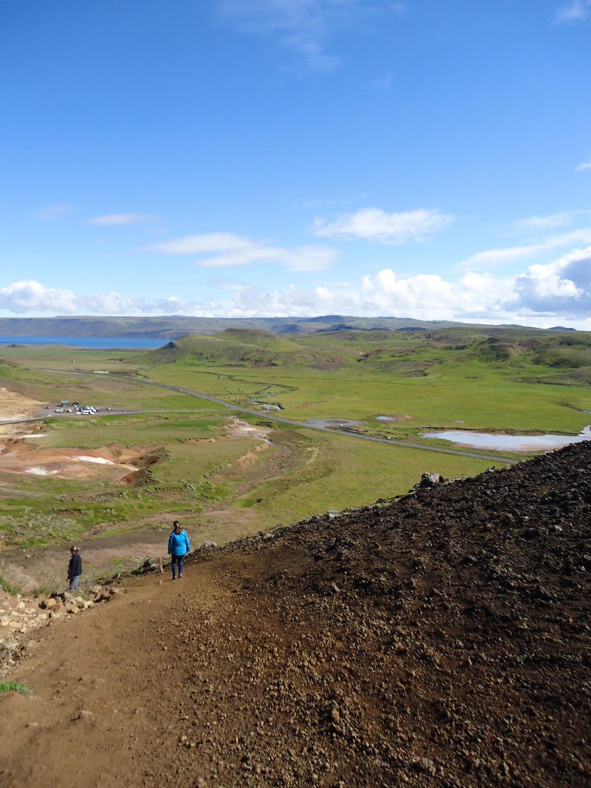
Some places have well marked trails. Some don't. I wanted to be flexible and not pre-plan too many hikes. I kind of wish I had planned more. And bought more hiking maps. Now that I've been there, I know where I would have liked to have spent more time. Or, I would do a ring road loop. Snaefellsjoull, Hengill, and Skaftafell had well marked hikes, and enough hiking to keep you busy for a few days. I felt like we spent a lot of time driving, and not enough time hiking. Since we stayed at so many different places (even within the same area), it took up more time. We would often drive 1-2 hours to wherever we were hiking. It would have been nicer if we could have stayed closer to where our hikes were. One thought - if you stayed in an RV, you could more likely camp in areas that have hiking. For example we couldn't find a place to stay right near Skaftafell. But they did have a campground right at the site.
We drove by many, many mountains. There were mountains in site wherever we were. It felt that many mountains were not very easily hikeable, because they had steep scree sides with flat tops. Just to steep to climb without sliding down. Finding pre-planned hikes online as much as possible is recommended.
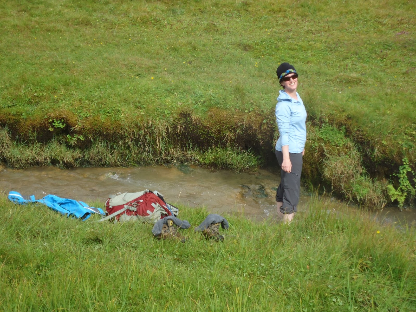
Hiking too a hot spring - a must do experience! Just come prepared with a bathing suit, large towel, and crocs.
Language:
Icelandic is spoken in Iceland. The country has around 300,000 people. That means there is no Pimsleur Icelandic or Rosetta Stone Icelandic. So, it isn't worth trying to learn. However - trying to figure out some of the pronunciation ahead of time is nice. And learning some of the names for the geographical features is useful. And the most important phrase - Malbik Endar - pavement ends. i.e. slow way down, your road is turning into gravel.
We didn't meet a single person who didn't speak English! So, it was super easy to communicate. Aren't we lucky! Most of the tourists we met there were from Europe - and every single one spoke English as well! Since very few people outside of Iceland speak Icelandic, English seemed to be the universal language of choice for the Icelanders to speak with to foreigners. I think the next most common language we heard there was German. But, we met/saw people from Belgium, Spain, Germany, US, Brazil, Italy, Holland, UK, Switzerland, Sweden, and Russia. I sometimes tried to guess people's nationality by the brand of hiking clothing they wore!
Most signs for tourist attractions are translated into at least English, if not more languages.
Scenery
Iceland has amazing scenery. It is like no place else! They have very few trees. The country has lava everywhere. And fields of sheep and ponies everywhere. There is so much space!
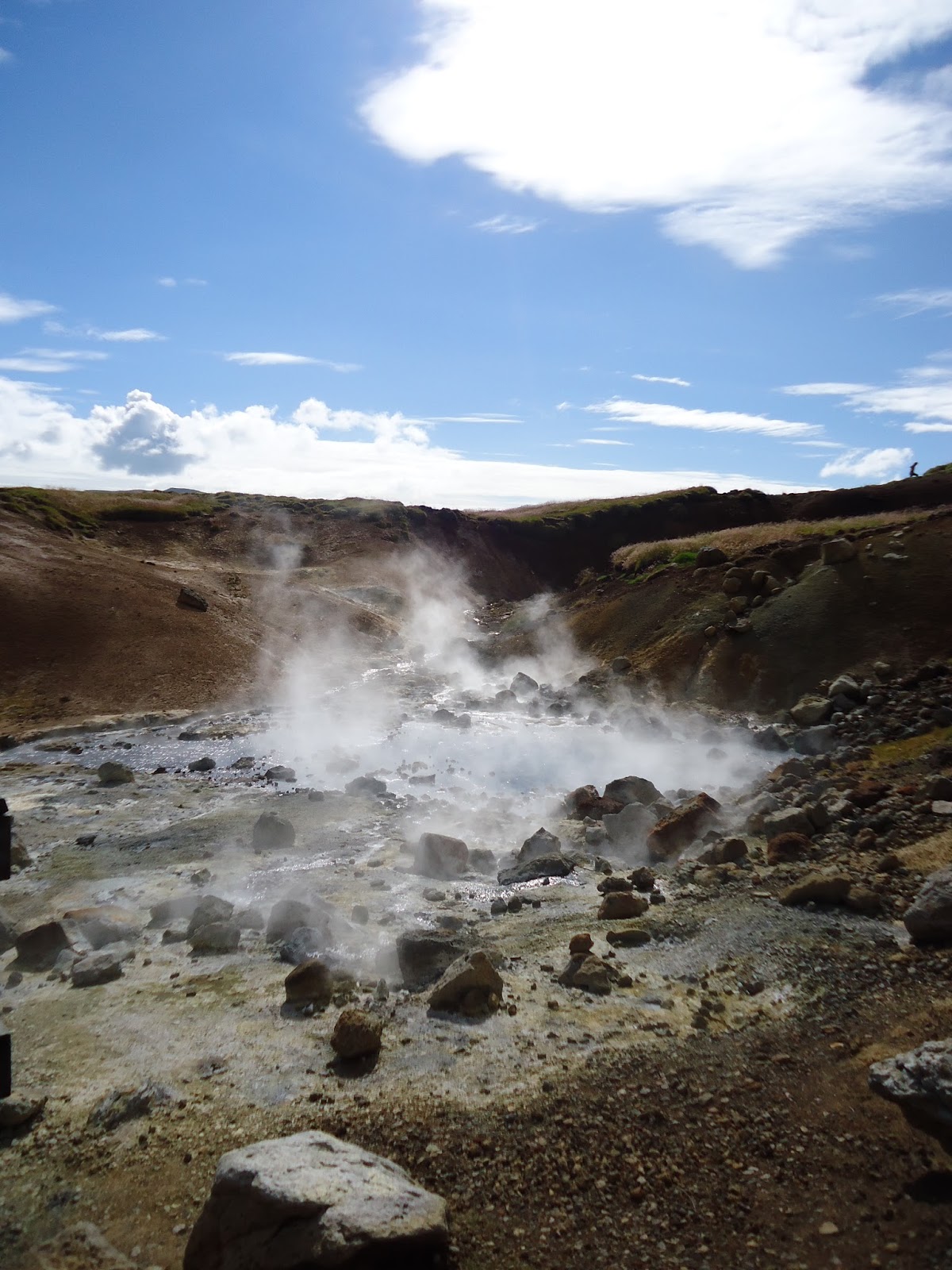
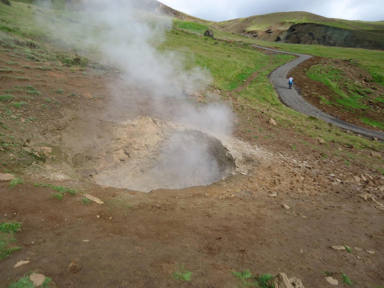
Volcanic eruptions & Earthquakes & weather
www.vedur.is is the site to use to check the weather. When we went in August, the temperature as 8-13 degrees Celsius. I didn't figure out what that was in Fahrenheit - I just got used to what those numbers felt like.
No volcanic eruptions while we were there :) The weather forecasting site documents them though. There are volcanoes everywhere.
There are multiple earthquakes every day in Iceland! They show them on the weather site. They show up as dots, with a range of how many hours ago they occurred. There were lots of dots every day we were there. However, we felt no earthquakes.
The weather website also has a seismic activity forecasting tab.
Wildlife
No wildlife to be afraid of - unless you count tourists parking in the road, or sheep wandering in the road.
We saw tons of birds (loved the puffins), tons of sheep, and tons of horses.
Also a few farms had cattle.
We saw a couple of seals.
You can go whale watching there, but we didn't.
Oh maybe scary wildlife - google "artic tern attack". I'm scared. Very scared!


