Wednesday, May 29, 2013

John H Chafee Nature Preserve, North Kingstown, RI

May 25, 2013
Distance: 2.1 miles
Time: 1 hour 9 minutes

Map: Weekend Walks in Rhode Island though if you want to do a straight out and back, there isn't a need for a map. There is one wide trail from the parking lot to the ocean. Several small side trails intersect it - I couldn't find a good map for these, including the book. My EveryTrail Iphone app had some, but not all of the side trails mapped. I decided to walk back using side trails, and relied on my phone to navigate them.

Parking: Large parking lot on Route 1A, just south of the intersection of Gilbert Stuart Road in North Kingstown, RI.
Restrooms: None
Post hike dinner: Whole Foods, Warwick

Directions: From parking area, follow the very wide trail straight to the ocean. You can come back the same way. However, I turned left and walked along the shoreline out to the peninsula, crossed to the other side of the peninsula, and then took dirt trails back (navigating with my phone at that point). I didn't follow trails along the beach. There is a trail that parallels the beach, but I wanted to walk along the beach as much as possible.

Notes: This is an easy hike. The beach on most of the hike is covered with shells and rocks, so if you worry about your dog cutting their feet, this might not be the hike for you. Trek's feet ended up fine. There were riptide warnings when we were there, so we didn't do any swimming in the ocean. We saw around 6 cars in the parking lot - most people we saw had dogs. But when we got to the beach, we were alone except for a couple looking at shells on the beach. The beach area is called Rome Point, and in the winter, it is a place to go to see seals. We were there past seal season.


Kiosk at trailhead. Shows a rough trail map.

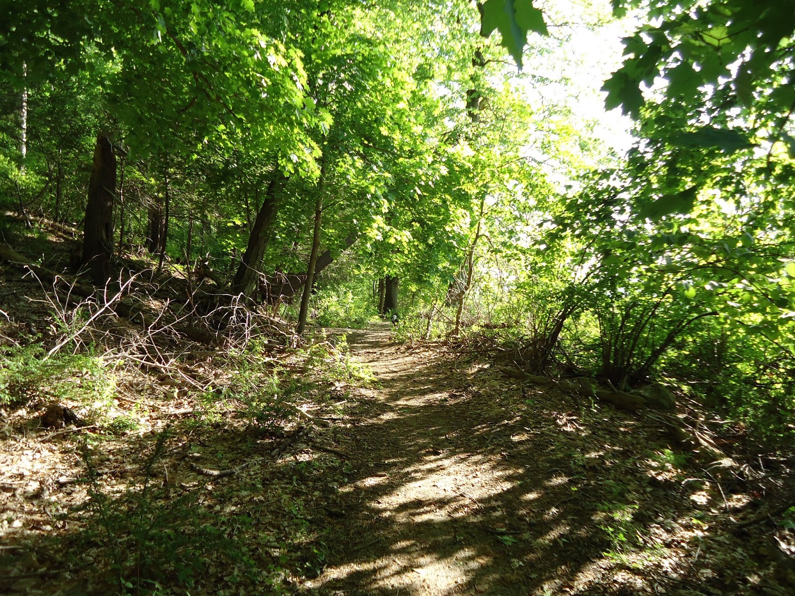
This is the main trail to the ocean. Impossible to get lost.

All we could do is wade, due to the riptides. No swimming today. It was a cold rainy day anyways.


We saw around 10 of these birds on the far side of the peninsula (our turnaround point).

Woodlands Legacy Fields Park, Yorktown Heights, NY

May 20, 2013
Distance: 2.4 miles
Time: 1 hour 9 minutes
Year to date miles: 116.8

Map: Woodlands Legacy Fields Park

Parking: At the end of Strang Boulevard (off of Route 132) in parking lot at the end of the sports fields. Notice there is a Strang Boulevard at the south end of the map. This is a dead end, and although it looks like a car could be parked there, there really isn't designated parking. The northern portion of Strang has a large parking lot, where lots of parents parked to watch their kids playing sports.

Restrooms: None that I noticed
Post hike dinner: None

Directions: From parking area, follow gas pipeline. Pass the green trail, then turn left on the blue trail.
Follow the blue trail to the end. Turn right on the yellow/white trail and cross a bridge. Immediately turn right on the yellow trail. Follow the yellow trail to the end. Turn left on the white trail. Turn right on the red trail. Follow the red trail to the end. Turn left on the white trail. Turn right on the green trail. Follow the green trail to the end. Turn right on the pink trail and return to parking area.

Notes: We didn't see anyone on the trails. The trails are also used by mountain bikers. We thought the hike was pretty, but when it gets near the Taconic State Parkway, it is very noisy. Luckily you can't really see the Taconic much from the trails, at least in the summer. This is an easy hike.


Trailhead. We should have started on the pink trail, but we ended up starting on the gas pipeline.

Gas pipeline, with the Taconic in the background.

Funky fungus


Bridge crossing on the yellow & white trails


Saturday, May 18, 2013

MA Appalachian Trail - Section 5 - Becket Road to Finerty Pond

May 18, 2013
Distance: 4.7 miles
Time: 3 hours 10 minutes (this includes lots of time at the pond!)
Year to date miles: 114.4

Map: October Mountain State Forest or book

Parking: If you start on Becket Rd, there is room for 2 cars right on the shoulder. If you start on Route 20, there is a large hiker parking lot. Our GPS did better at finding the intersection of Tyne Road & Route 20, Becket, MA. It brought us to the same intersection we were expecting (Becket Road & Route 20).

Restrooms: None
Post hike dinner:  Berkshire Coop

Directions: AMCs Best Day Hikes in the Berkshires (we shortened the hike by 1.4 miles by starting on Becket Rd.

From the parking area on Becket Rd cross the street and continue along the white blazed AT. Becket Mountain has a sign & a trail register. There is no view. Continue on to Walling Mountain (we didn't notice where it was - no view, and minimal elevation gain). Descend from Walling Mountain to Finerty Pond. The trail doesn't go immediately next to the pond, but you can easily walk over to the pond. Continue along the AT until it starts to leave the pond. Retrace your steps.

Notes: Not really a difficult hike. The mountain summits were unremarkable. The highlight of this hike was letting the dogs swim in the pond. If you start at Becket Rd, there are no road crossings. We saw 4 other people on the hike, including a section hike.

Parking area on Becket Road.

Sign for Becket Mountain

Trail register on Becket Mountain

Just before you reach the pond, the AT crosses Finerty Trail. Continue straight on the AT.

Two happy dogs.


Friday, May 17, 2013

Garrison School Forest - North and South Redoubt

May 17, 2013
Distance: 2.1 miles
Time: 1 hour
Year to date miles: 109.7

 Map: East Hudson Trails Map and this map is very helpful for parking Garrison School Forest
It is helpful to have both maps. The Garrison School Forest Map shows trails more clearly than the NYNJTC map. But the Garrison School Forest Map doesn't include North Redoubt.

Parking: We spent a long time trying to figure out where to park. Now we know. Parking is easier to see on the online map versus the NYNJTC map. We parked at #135 Snake Hill Road. It is someone's driveway, but it isn't as bad as it sounds. There is a sign for #135 on the road. Drive down the gravel driveway. There is a house on the right, but keep to your left and pass it. The driveway becomes a bit "rugged" - and you wonder if you are driving down a trail rather than to a parking area. But, just a bit past the house there is a parking area with room for around 5 cars. There is a triangular sign which looks like it used to read "PARK HERE".

Restrooms: None
Post hike dinner:  None

Directions: From the parking area, head towards the Private Property sign. This is the start of the red trail to North Redoubt. It goes through a meadow area. The blazes are spotty. Look for a cairn on your left where the red blazed trail goes straight (towards Snake Hill Road) or sharply left to North Redoubt. Turn left and ascend to North Redoubt. There is a swing at the top, and then the trail continues a little further. Views are obstructed. Retrace your steps back to the parking area. Then take the red trail south towards South Redoubt. There is a sign at South Redoubt which gives some information on the history of the area. The views from this area are much nicer than North Redoubt. Retrace your steps back to the parking area.

This hike can be extended with other trails.

This is the parking area. Look for that triangular sign on the tree.


So, yes, it says private property, but this is the trail to North Redoubt.

Trek at first view on North Redoubt, next to swing (not in photo). Trek hated the swing!

Obstructed view at North Redoubt.

Sign with information on the South Redoubt site.


View of the Hudson. Continue a little further for an even better view.

View of West Point across the Hudson River

Trek

Garrison School Forest was donated by the Sloan and Osborn (same family that owned Castle Rock) to the Garrison Union Free School District.

Thursday, May 16, 2013

Castle Rock Unique Area, Garrison, NY

May 16, 2013
Distance: 4.5 miles
Time: 2 hour 13 minutes
Year to date miles: 107.6

Map: East Hudson Trails Map

Parking: Wing & Wing Rd (east side of route 9D), Garrison, NY. Parking area at the end of the dirt road has room for around 4 cars. Signs show you where to park.

Restrooms: None
Post hike dinner:  None

Directions: From parking area, head towards meadow (blue blazed trail). Cross  meadow and continue following blue blazed trail. At gazebo continue straight onto red blazed Sugarloaf trail. At intersection, turn right onto red blazed trail and head towards summit of Sugarloaf Hill. Continue along a ridge until the end of the trail, where there is a view of the Hudson River. Retrace steps back to the intersection. Turn right onto the red blazed trail. Just before a stream turn right onto an unmaintained woods road. We missed this at first, but the turn is immediately before the stream. Follow the unmarked woods road as it follows a stream, and then parallels Route 9D. Rejoin the red trail. Turn left (no blazes immediately apparent) into the meadow. When you reach Wing & Wing road, turn right and return to the parking area.

Notes: LOVE the castle!  The castle is private property, but the view of the castle from the meadow is wonderful.  I also like hiking through meadows. The hike up Sugarloaf Hill is pretty steep.

We couldn't tell the name of the street to park on from the East Hudson Trails Map. The street is called Wing & Wing, and there is also a sign for Castle Rock.


Driving down the road, there are signs telling you where to park. And that the castle is private property.

Parking area has room for around 4 cas.

At the end of the parking area. The trail starts out towards the pump house.


First view of Castle Rock

It looks like a fairy tale

Crossing the meadow. The trail is slightly mown.

At the end of the meadow, the trail turns right onto a woods road

Gazebo at the intersection with the Sugarloaf Trail

Near the Sugarloaf Hill summit. Keep going for the views.

View at the end of Sugarloaf Trail. View of the Hudson River and Bear Mountain Bridge.


Along the woods road that parallels 9D.

Turn left at a faint path into the meadow. No blazes for a while.

Manitoga, East Hudson Highlands

May 14, 2013
Distance: 2.3 miles
Time: 1 hour 18 minutes
Year to date miles: 103.1

Map: East Hudson Trails Map

Parking: Garrison, NY, turn right onto gravel driveway with gate
Restrooms: None
Post hike dinner:  None

Directions: Dragon Rock. Then White trail + yellow trail

Notes: This is the former house & grounds of Russell Wright. Beautiful house!

Technical issue - no photos :(

Monday, May 13, 2013

Ward Pound Ridge Reservation - Green Trail Loop

May 13, 2013

Distance: 3.4 miles
Time: 1 hour 10 minutes
Year to date miles: 100.8

 Map: Ward Pound Ridge Pick up a map when you pay for parking.

Parking: Enter park, pay for parking and keep driving straight until you see a sign for Michigan Road. Turn right on Michigan Road, and park at the end of the road (lower parking area). There is plenty of parking. Cost is $10 without a Westchester County Parks Pass. $5 with a Parks Pass. There was no parking attendant when we arrived in the evening, so it was free.

Post hike dinner: none
Restrooms: None

Directions:
More information on the park: Ward Pound Ridge Reservation
From the lower parking area, find trailhead at kiosk next to swampy bird nesting area.
Follow the green trail.
Early on the green trail splits - you can go left or right.
We went left and did a clockwise loop.
The loop will end at the parking area.

 Notes: This is a very popular park. This hike was easy. This trails are very clearly blazed and wide. The map also has numbers at intersections which correspond to numbers posted on trees. On some trails, you will come across a lot of people. We saw two other dog walkers/joggers.
Culdesac just beyond parking area

Trailhead

Follow the green blazes the whole way

Stream next to the trail