Sunday, March 31, 2013

Haystack Mountain, Norfolk, CT

March 30, 2013

Distance: 2.3 miles
Time: 1 hour 20 minutes

Map: Haystack Mountain State Park

Parking: Directions During the winter, the park road is closed with a gate. The gate has signs - no parking, and don't block the gate. I parked on the park road, as much to the side of the gate as I could. By the time we left, there were 2 more cars parked there, one blocking the gate. So, room for 2-3 cars only, in the winter. The park road is off of Route 272 in Norfolk, CT. There are signs for Haystack Mountain before you reach the road.

Restrooms: none
Post hike dinner: Jewel of Himalaya

Directions: If you park right at the beginning of the park road, look for the sign for the Haystack Tower Loop Trail, to the right of the paved road. It is a yellow blazed trail. Where the yellow trail splits (yellow goes both straight and to the right), stay straight. Where the yellow trail splits again (yellow goes both left and straight), stay straight. Arrive at the tower. You can walk up the tower any time of year. It is a nice sturdy stone tower (I'm not fond of climbing metal/wood fire towers). There are mountain views from the top of the tower. There is an interesting sign next to the fire tower about someone who wanted to prove that the Encyclopedia at the time was incorrect in stating that there were no peaks in CT above 1,000 feet.

There is a loop that goes around the tower. We had to go around the loop once before we found the yellow trail continuation. Make sure not to take  the yellow trail the way you came up, and you'll be good. Descending on the yellow trail felt strange. It felt like we were spiraling, but never crossed the trail we did going up. We kept spiraling clockwise, following the yellow blazes. Eventually we stopped spiraling, and could see route 272 to our left. The trail approaches but doesn't cross Route 272. Continue along the yellow trail until you hit a T intersection with the same yellow trail. Turn left and continue to the starting point.

Notes: This hike is moderately easy. There is elevation gain, but nothing very difficult. We did hit a lot of snow descending the  north side of the mountain.

Year to date miles: 24.9

Parking in front of the gate

Sign at the beginning of the trail (to the right of the gate)


Haystack Mountain tower


Moxie exploring


Trek & Moxie, summit photo

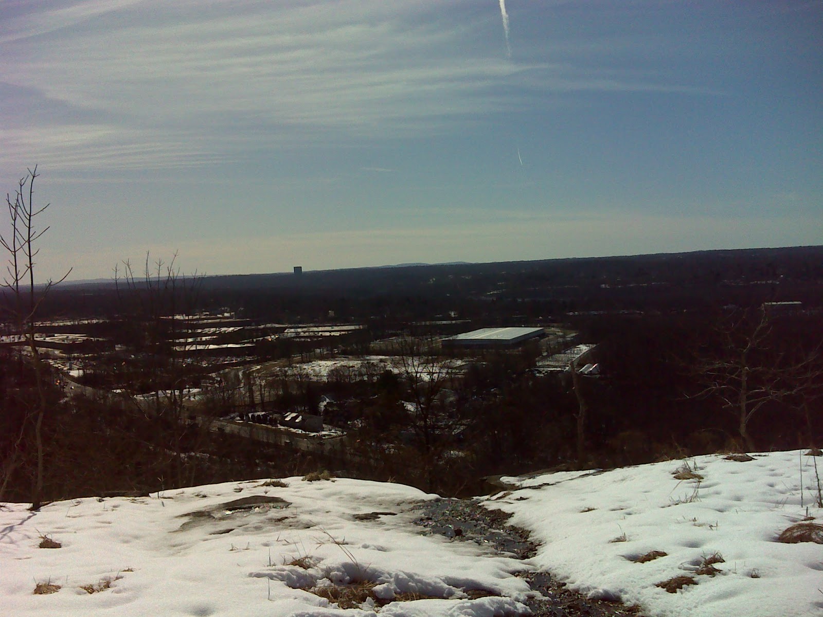
Views from the tower


Fire tower ceiling


Lots of snow on the way down. The dogs enjoyed it, but we were post holing, almost up to my knees in spots.

Friday, March 29, 2013

Long Path to Long Mountain Summit, Harriman State Park

March 29, 2013

Distance: 2.2 miles
Time: 1 hour 22 minutes
Map: Harriman - Bear Mountain Trails - Northern Trail Map 119
Parking: Off of Route 6, west of Long Mountain Circle. Plenty of room for lots of cars. Some people park there and just hang out in their cars (non-hikers).
Restrooms: none
Post hike dinner: Jewel of Himalaya

Directions: Long Mountain Loop, Harriman

Notes: This was a fabulous hike. It provides great views at the summit for minimal effort. There  are no road crossings. It also has a stream after you descend Long Mountain. We only saw 3 other hikers out on the trail today (though many cars parked in the parking area).

Year to date miles: 22.6

Trailhead


View looking back as we ascend Long Mountain

Climbing to the summit. Love the sunny weather.


View of Bear Mountain

Memorial to the founder of the NYNJTC. We certainly appreciate all the NYNJTC does!

View as we descend


Stream right before past the turn onto woods road. The woods road follows the stream for a while.


Walking along the woods road


Sunday, March 24, 2013

Butter Hill/Stillman/Bluebird Trail Loop, Storm King

March 24, 2013
Distance: 3.5 miles
Time: 2 hours 54 minutes
Map: West Hudson Trails Map
Parking: Pull out off of 9W. Room for around 20 cars.
Restrooms: none
Post hike dinner: n/a
Directions: Butter Hill/Stillman/Bluebird Trail Loop from Route 9W

Notes: This hike climbs up Butter Hill, which has 360 degree views of the area. It also climbs up Storm King Mountain. There are several spots on this hike with lovely views of the Hudson. The initial climb on this hike is strenuous, with some rock scrambling. The remaining hiking is moderate. For those with vertigo, the Stillman Trail, where it follows the steep side of Storm King Mountain, might be hard. I had to pull out my microspikes to be comfortable hiking on it, and there were still some tricky sections.


Parking area off of Route 9W, north of the Bear Mountain Bridge
View from the parking area
A peak at the Hudson River
On the orange trail, ruins of a former house
9W

Bannerman's Castle on the island

Sunday, March 10, 2013

Talcott Mountain, Simsbury, CT

March 10, 2013

Distance: 4.6 miles + short road walk
Time: 2 hours 32 minutes
Map: Talcott Mountain State Park
Parking: Off of route 185, at sign for Heublein Tower. The parking lot was closed for the winter, so there was only parking at the beginning of the park entrance road. Room for around 20 cars packed in. I later saw that there was a much nicer parking area (open) at Penwood State Park, where my hike ended.
Restrooms: At Heublein Tower
Post hike dinner: No

Directions:
Follow park road, and turn left onto the yellow trail at the sign for the Heublein Tower. This is a 10' wide very popular trail. The trail was packed with wet heavy icy snow.Most of the people I saw were just wearing sneakers. The hike is uphill to the tower, definately tiring with the slushy footing.

Once you stop and see the tower (only open in the summer), continue on past the picnic area, and pick up the blue blazed Metacomet Trail. At this point you leave most of the people behind. The blue trail crosses a road (which goes to the tower), then crosses a gas pipeline, and a power line. There were a lot of blue blazed trees which weren't trail markers - presumably they were spray painted because they were dead and needed maintenance. I just wish they had chosen a different color.

The blue trail ends at the blue/red blazed Metacomet Alternate trail. I found the turn here a little confusing, as I didn't see any blazes for a while, but if you look at the map it helps. As soon as the blue blazed trail ends, turn left on a wide woods road. There is a large beautiful lake in front of you and to your right. Cross a bridge at the end of the lake, and then turn left again (here you could go straight - not shown on the map, left or right). Eventually you will see the blue and red blazes. This trail was mostly unbroken trail, with 10" of snow in spots. It was also wet - sometimes I would fall through the snow into a stream from melting snow. There will be a sign to the left for the Heublein Tower, but ignore it and continue straight. Pass the gas pipeline and the power line again.

The red and blue trail ends at the blue trail. Turn right on the blue trail. Pass the power lines again. The trail ends at Route 185, which is a very busy road. The parking area is off route 185 to the left. I didn't feel safe walking along the road, so I crossed the street, walked in the Penwood parking lot, and then on a grass shoulder until I came to the park entrance - and crossed the street again.

Notes: This was an enjoyable hike. You'll have lots of company heading towards the tower, but once past the tower, there are very few people.

A longer loop could be created. A shorter loop (3.1 miles) is described as hike #24 in AMC's Best Day Hikes in Connecticut.


Normally this is the road to the parking area

Start of the tower trail

Heublein Tower


View near the tower

Road crossing - this is a road that goes up to the tower. No one on it today :)

Large lake. Turn left here.

Just after crossing the bridge. View of the lake. Turn left (away from lake)


Blue & red blazed trail

Side trail - don't take this.

Passing under the power lines


Moxie

Sign at the end of the trail.

Saturday, March 9, 2013

Buttermilk Falls in Rockland County

March 9, 2013
Distance: 1.2 miles
Time: 25 minutes
Map: Buttermilk Falls Park
Parking: Large parking lot on South Greenbush Road. See directions. West Nyack, NY.
Restrooms: No
Post hike dinner: No
Directions: Buttermilk Falls County Park

Notes: I give this hike a thumbs down. The hike has constant car noise, and the views on the hike overlook Nyack. The hike is in a very urban area. Not worth doing again.

Year to date miles: 20.4
Meadow view


City view


Sign at parking lot

Friday, March 1, 2013

Douglas State Forest, Coffeehouse Loop

March 1, 2013
Distance: 2.6 miles
Time: 1 hour 10 minutes
Map: Douglas State Forest Detail Map
Parking: Park entrance is near 107 Wallum Lake Road, Douglas, MA. Sign for the main park entrance is there. I planned to park at the parking area on the map indicated by "P" next to the nature center. That part of the road was closed (unplowed). Instead I kept left, and parked at the boat ramp area next to Wallum Lake.

Restrooms: In parking lot
Post hike dinner: Chipotle, Marlborough

Directions:
Since I couldn't park where I originally intended, it was a little more confusing to find the start (and then the end) of the trail. Otherwise the trail was well marked.
At parking lot, continue on road (no vehicular access) with the lake on your left. Head towards the Nature Center. There is a sign near the Nature Center saying turn right to head towards the Coffeehouse Loop trail. Turn right and continue along that road. You'll pass a trail on your left. The road ends at a sign saying turn lef for the Cofee House Loop trail. Turn left, now you are on the trail.
The trail has blue blazes throughout. It is a clockwise loop. Sometimes the trail is joined by other trails. The trail ends at a road, which is actually the closed circular parking lot. Turn right on the road. Then, get back on the trail where the sign says no vehicular access. Continue on this until you see the original sign for the Coffeehouse Loop trail. Turn left and follow trail back to parking.

Notes:
In the summer Wallum Lake is probably crowded with bathers. Today, we didn't see anyone on our hike. Parts of the trail were very flat & wide, and then parts were more trail-like. This was an easy hike, though I did need microspikes due to the snow and ice. There are a couple of streams which might be nice for dogs in the summer. I think these trails are also used by equestrians and mountain bikers.

Sign for park entrance
Boat ramp parking lot.
Sign near nature center
Start of the trail. You will end up here again.
The trail is joined by the Midstate trail (which is a little more rugged than parts of the Coffeehouse trail).
One happy dog!
One of the stream crossings
At the end of the Coffehouse trail, turn right onto a road which quickly ends at the circular parking lot.
Keep the parking lot on your left.
Keep to the right at the Do Not Enter sign.
This trail will lead you back to the "Coffeehouse Loop Trail 2.2 miles" sign.