Monday, October 29, 2012

Goshen and Stevens Mountains attempt, Harriman

October 27, 2012
Distance: 4.4 miles
Time: 3 hours
Map: Harriman - Bear Mountain Trails
Parking: Large parking lot, Tiorati circle on Seven Lakes Drive. Park near first dumpster. The trailhead is right near it.
Restrooms: Porta potties in nearby parking area
Post hike dinner: none
Directions: Goshen and Stevens Mountains
Light blue blazedLake Tiorati trail to intersection with Ramapo Dunderberg trail.
Turn right on Red dot on white blazed RD trail.
We hiked to view of Lake Tiorati, and then backtracked.

Notes:
We didn't complete this hike - Glen had boot problems. This parking area was pretty crowded, considering it was the end of October. There were a lot of families having picnics next to the parking lot. However, the trails were empty. In the summer, this parking area is often filled. This hike crosses Seven Lakes drive twice.

Year to date miles: 340

The last of the fall foliage
Dogs were super energized - I had to throw some sticks for them to keep them from running too far ahead.

Tuesday, October 23, 2012

Mullica River Trail to Beaver Pond, Wharton State Forest

October 22, 2012
Distance: 5.4 miles
Time: 2 hours 56 minutes
Map: We picked up a map at the park office in the parking area
This map is online: Batona - but the map from the park office was clearer

Parking: Large parking area next to the park office - Route 206 in Atsion, NJ
Restrooms: In field behind parking area
Post hike dinner: Whole Foods, somewhere in NJ
More park information
Atsion
Wharton State Forest
Directions:
We based our hike on the description in the link below. However, we only had 1 car, so we didn't do this as described. If you had 2 cars, you could do an approximately 10 mile hike between Atsion and Batso.
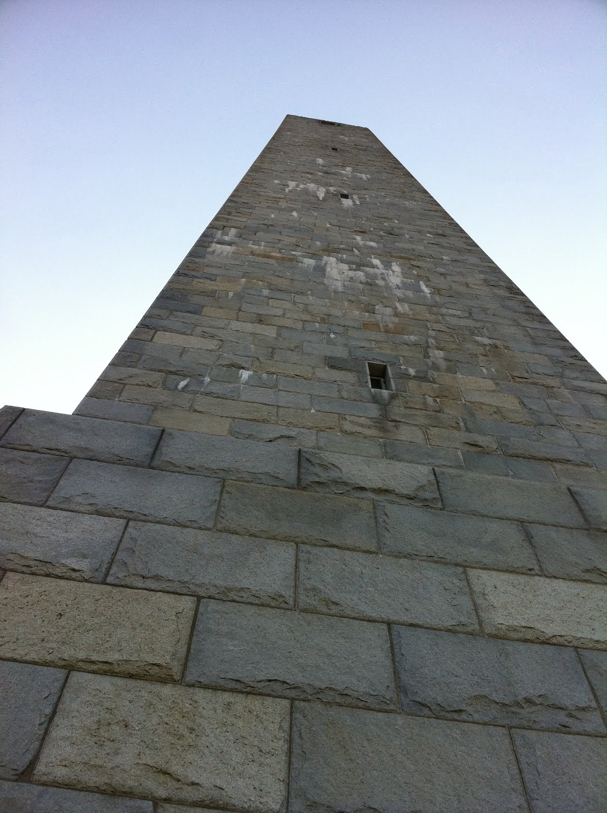
Atsion Carranza Monument

The yellow blazed Mullica River trail starts on the right side of the park office. It passes by a hunting club on the right & a church on the left before going into the woods on the left. We followed the yellow blazed trail for 2.7 miles until the Mullica River trail swelled into what I guess is considered Beaver Pond (location where the Mullica River trail intersects with the Beaver Pond Quaker Bridge trail).

This trail is very flat. The footing is very nice - sandy with pine needles. Not rocky at all.
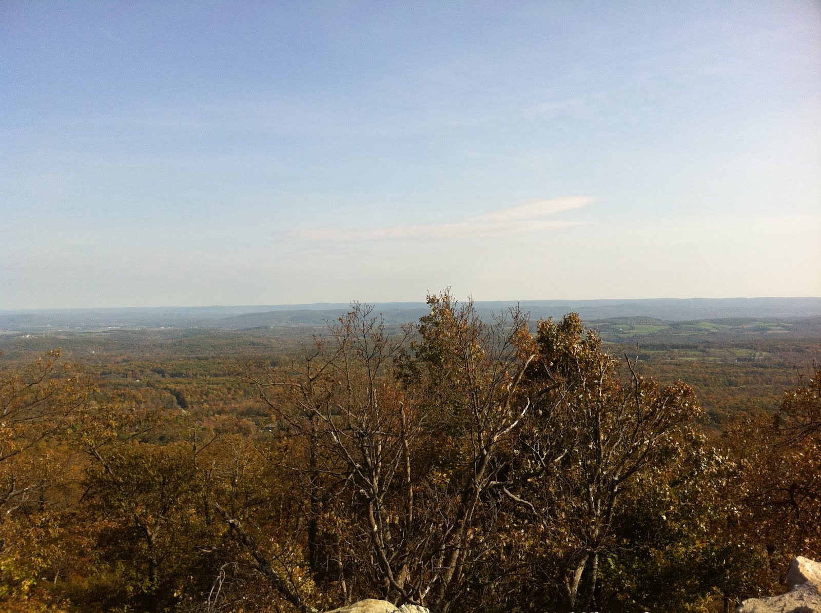
The first 1 1/2 miles or so were not very scenic. A lot of leaves were already down, so it was looking kind of grey. Also there were clear cut areas which scarred the landscape. As we got closer to the Beaver Pond area, it was much prettier. More color, and I thought the Beaver Pond area was very pretty. It really isn't a good place for swimming - the water is very shallow.
The trail is crossed by numerous sand/gravel roads. Horses aren't allowed on the smaller trails, but are allowed on the larger trails/sand roads. We also saw the occasional truck on the sand roads. I'm not sure what they were doing - most weren't park trucks. It isn't safe to have dogs off leash here due to this - as you can't always see when you are about to intersect with a sand road.

We did this as a 5.4 mile out and back. Atsion to intersection of Beaver Pond, and back to Atsion.
We were hoping to drive across the street and do a 1 mile loop next to Atsion Lake on the Atsion Lake Trail, but this area had a locked off parking area which closed at 4pm.

Year to date miles: 335.6
Trailhead for yellow blazed trail
Crossing an abandoned railroad
The distance to Batso is posted every .5 miles
Reds in the short brush
Sign at our destination
Beaver Pond, which looks more like a swampy area, but was very pretty
We tried swimming, but it was just wading
Taking a rest next to the pond
Camo Trek in the pine barrens

Patapsco State Park, Woodstock area, Woodstock, MD

October 21, 2012
Distance: 8.2 miles
Time: 3 hours 57 minutes
Map: We couldn't find a good map online. This might cover the area:Patapsco Valley State Park
We ended up using EveryTrail (Iphone app) which had trails marked.

Parking: Limited parking area across the street from the Woodstock Inn, on Woodstock Road in Woodstock Maryland. Room for around 10 cars (this is also the parking lot for the Inn).
1415 Woodstock Rd. Woodstock, MD 21163 
Down by the railroad tracks - down the hill from the snowball stand
Parking is free. Room for around 10 cars.
People park their horses here too!

Restrooms: none
Post hike dinner: Great Sage Clarksville, MD

There were very few people in this section of the park. Most of the people we saw were mountain bikers. Equestrians also use this trail. The trail is mostly level, with some small hills.

Directions: From the parking area, cross the bridge over the Patapsco River. At the end of the bridge, turn left on paved road (authorized vehicles only) down to the trail. Turn left on the trail (head under the bridge). Follow yellow blazes. There are side trails - a map is really needed, as the trails can be a little confusing. At one point there is a loop, and we went clockwise around the loop, to form a lollipop, eventually backtracking for part of the trail.

The trail follows the Patapsco River for a short distance. It later goes behind some very large houses, and passes through a power cut. It wasn't particularly scenic, though the river and one of the meadows is nice.

Year to date miles: 330.2
Parking area. One of the horse parkings spots.
To get on the trail, cross the railroad tracks & bridge, and turn left
Last of the fall color.
Pretty meadow area
Remains of a fireplace we saw just off the trail
Patapsco River
Crossing the power cut

Patapsco State Park, McKeldin area, Ellicot City, MD

October 21, 2012
Distance: 3.7 miles
Time: 1 hour 38 minutes
Map: Ask the parking attendant for a trail map of the McKeldin area. The map has color coded trails. It only shows the McKeldin area of the park, not the whole park. We couldn't find a good map online.
Parking: $5/person for out of state visitors
Restrooms: At the parking area
Post hike dinner: Great Sage  Clarksville, MD

More park info & park directions: Patapsco McKeldin

There were a lot of people in this section of the park, including lots of dogs (on leash). This park is also very popular with equestrians. The trail is mostly level.

Directions: We pieced together sections of trails to come up with a hike to meet our needs. Shorter or longer hikes are possible.

Year to date miles: 322

Trek and I at the Patapsco River
Trek, Burn, Moxie, Chewie, Crash

Sunday, October 14, 2012

Monument Trail Loop, High Point State Park

October 14, 2012

Distance: 5.5 miles
Time: 3 hours 13 minutes
Map: Kittatinny Trails Map
Parking: Turn off road at Boat Launch parking area sign. Parking is free here. However, only room for around 3 cars at this parking lot. There are other hike variations where you can park in other much larger parking lots.
Restrooms: In parking lot for monument, but they were already closed for the winter
Post hike dinner: Jewel of Himalaya, Yorktown Heights, NY
Directions: Monument Trail Loop from Steeny Kill Lake

Notes: This trail goes by the NJ State high point. We are going to try to do a few state high points. Not all of them, but we thought it would be fun to do the ones in our area. We've done the MA state high point, so this would be our second one.

There are a lot of people at the monument - because you can drive to it. And more people than I like on the Monument loop. That meant dogs on leash for a lot of the hike. On the positive side, there were 2 lakes. We swam the dogs of the lake closest to the parking lot.

Year to date miles: 318.3
State High Point #2


Paved boat launch. Trailhead is next to the lake, just to the left.
Trailhead. Some of the trails are overgrown on this hike.
Our destination
We got lost here. At the end of the lake, there is a stream crossing.
We figured this was the stream crossing described in the directions.
We ended up crossing here, and following a trail to the right along the lake.
We ended up at someone's house. Oops. Backtracked.
Instead of taking the trail that looks like it should be the trail, we are supposed to take this.
The trail goes to the left right at the end of the lake BEFORE the stream crossing.
There is a blaze in here. Hard to miss!
We took it easy during this hike, taking more rest breaks than usual.
We stopped at the second stream crossing (small detour to sit on a bridge) to let the dogs have some fun.
This is the second lake. Not as exciting, because there is a parking lot & road next to it.
We didn't stop to swim here. Dogs on leash, as we had to walk a short ways on a paved road.
Glen, Trek, and Moxie at the NJ high point monument.
When I gave the dogs to Glen and have him pose, lots of young kids ran up to the dogs.
We had to wait a while until they cleared out enough to take a photo.
Looking up at the monument.
View from the high point.
We continued on the Monument Trail Loop, passing a number of view points.
We left the Monument Trail Loop to go on the short Cedar Swamp Trail.
The Cedar Swamp Trail has a boardwalk over a bog.
The hike returns to the Steeny Kill Lake, with a nice grassy path alongside it.
The dogs were running like crazy!
And the packs come off, and Moxie is out for a swim, with Trek watching.
A woman came up and started photographing the dogs as they were swimming.
Guess I should have taken off their dorky GPS collars.

Windham High Peak, Catskills

October 13, 2012
Distance: 7.3 miles
Time: 4 hours 35 minutes
Map: Catskill Trails Map Set
Parking: Parking lot on Route 23/Cross Road intersection in Windham. The lot was very full.
Restrooms: none
Notes: Catskill 3500 footer
Post hike dinner: Yum Yum Noodle Bar  Woodstock, NY (I just noticed on their website that they now have a food truck!)

Directions: From parking lot, cross the street to get onto blue blazed Escarpment Trail.
After 1.05 miles, pass yellow blazed Elm Ridge trail on right.
Continue on Escarpment Trail to the summit, and retrace steps.

Notes: This is one of the easier Catskill 3500 footers. There were many leaf peepers out. Some of the lower trails are used by mountain bikers. The ones we met were very dog friendly - I was worried about my off leash dogs passing them, but they were good!

Year to date miles: 312.8
Catskill 3500 footer # 15

Sign at trailhead, across th street from the parking lot
Moxie
Intersection with Elm Ridge trail
Lean To on Escarpment trail
There are no views at the actual summit. But there are 2 lookouts immediately before the summit marker.
View to the north I think - this mountain is at the northern edge of the Catskills, so not very mountainous in the distance.
View to the south - Blackhead, Black Dome, Thomas Cole